MyTopo
Rally Hill Tennessee US Topo Map
Couldn't load pickup availability
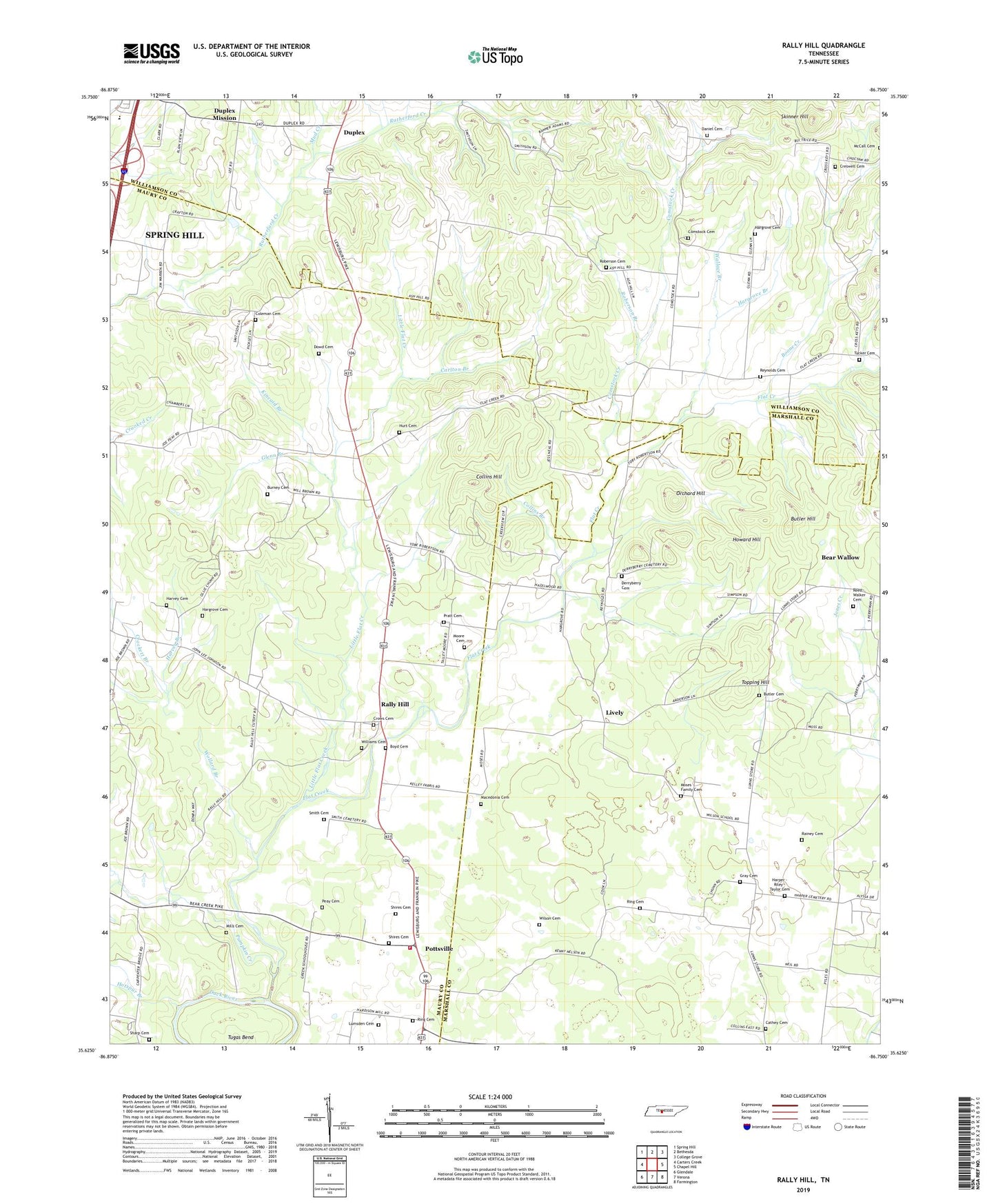
2019 topographic map quadrangle Rally Hill in the state of Tennessee. Scale: 1:24000. Based on the newly updated USGS 7.5' US Topo map series, this map is in the following counties: Maury, Marshall, Williamson. The map contains contour data, water features, and other items you are used to seeing on USGS maps, but also has updated roads and other features. This is the next generation of topographic maps. Printed on high-quality waterproof paper with UV fade-resistant inks.
Quads adjacent to this one:
West: Carters Creek
Northwest: Spring Hill
North: Bethesda
Northeast: College Grove
East: Chapel Hill
Southeast: Farmington
South: Verona
Southwest: Glendale
Contains the following named places: Adkinson Farms, Ash Hill, Ash Hill Cumberland Presbyterian Church, Ash Hill School, Bear Wallow, Boone Creek, Boyd Cemetery, Browns Chapel, Burney Cemetery, Butler Cemetery, Butler Hill, Carlton Branch, Cathey Cemetery, Cedar Dell Church, Choctaw School, Coleman Cemetery, Collins Branch, Collins Hill, Comstock Cemetery, Comstock Creek, Corinth Church, Creswell Cemetery, Crockett Branch, Crows Cemetery, Daniel Cemetery, Derryberry Cemetery, District 25, Dowd Cemetery, Duplex, Duplex Mission, Flat Creek, Glenn Branch, Glenn Chapel, Glenns Store, Gray Cemetery, Hargrove Branch, Hargrove Cemetery, Harper - Riley - Taylor Cemetery, Harvey Branch, Harvey Cemetery, Hatton Chapel, Hotspur Branch, Howard Hill, Hurt Cemetery, Hurts Cross Roads, Kincaid Branch, Lee Buckner School, Lees Corner, Lees Corner School, Little Flat Creek, Lively, Lumsden Cemetery, Lunns Store, Macedonia Cemetery, Manasseh Church, Maury County Fire Department Station 7 East Maury, McCall Cemetery, McCrowerys Corner School, Mills Cemetery, Moore Cemetery, Moses Family Cemetery, Mud Creek, New Bethel Church, New Macedonia Freewill Baptist Church, Old Lasea Church, Orchard Hill, Peay Cemetery, Pottsville, Pottsville School, Pratt Cemetery, Pumpkin Creek, Rainey Cemetery, Rally Hill, Reed - Walker Cemetery, Reeds Store, Reynolds Cemetery, Ring Cemetery, Roberson Branch, Roberson Cemetery, Rural Hill Church, Sharp Cemetery, Sharp Corner Church, Sharps Corner, Shires Cemetery, Skinner Hill, Smith Cemetery, Topping Hill, Tucker Cemetery, Tugas Bend, Wallace Branch, Williams Cemetery, Wilson Cemetery, Wilson School, Wollard Branch