MyTopo
College Grove Tennessee US Topo Map
Couldn't load pickup availability
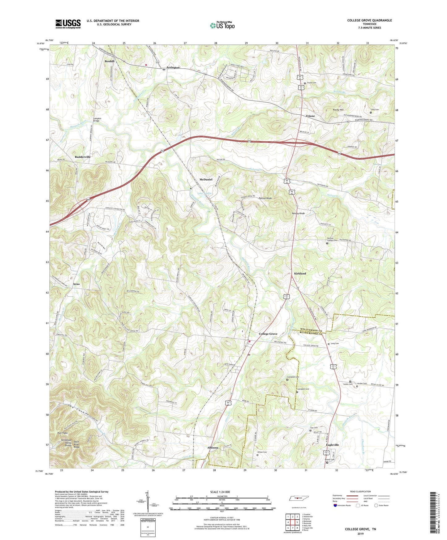
2022 topographic map quadrangle College Grove in the state of Tennessee. Scale: 1:24000. Based on the newly updated USGS 7.5' US Topo map series, this map is in the following counties: Williamson, Rutherford. The map contains contour data, water features, and other items you are used to seeing on USGS maps, but also has updated roads and other features. This is the next generation of topographic maps. Printed on high-quality waterproof paper with UV fade-resistant inks.
Quads adjacent to this one:
West: Bethesda
Northwest: Franklin
North: Nolensville
Northeast: Smyrna
East: Rockvale
Southeast: Rover
South: Chapel Hill
Southwest: Rally Hill
This map covers the same area as the classic USGS quad with code o35086g6.
Contains the following named places: Allisona, Allisona Chapel, Allisona Church, Arno, Arrington, Arrington Creek, Arrington Fire and Rescue Station, Arrington Post Office, Bellview Church, Benchmark Farm, Benhill, Campbell Cemetery, Cary and Winn Male Academy, Cheatham Branch, College Grove, College Grove Elementary School, College Grove Post Office, College Grove United Presbyterian Church, Cove Branch, Duck River Ridge, Flemingsburg, Grove Creek, Guy Cemetery, Harlinsdale Farm, Harpeth Lick Church, Hillwood Acres, Jordan Cemetery, Kirkland, Kirkland School, Lake Tomlin, Lampkin Bridge, Lampkin Bridge Estates, Locust Ridge Church, Long Cemetery, McCrory Creek, McDaniel, Mount Pleasant Church, Mount Zion Church, Nelson Creek, Newton Cannon Cemetery, Patton Knob, Pull Tight, Rocky Hill, Rudderville, Russell Cemetery, Scales Cemetery, Shady Grove Church, Starnes Creek, Stony Point Farm, The Cove, Triune, Triune Cemetery, Triune United Methodist Church, Watson, Wesley Chapel, Williamson Fire / Rescue - Station 18, Wilson Branch, Wilson Cemetery, Wilson Creek Primitive Baptist Church, Yancey Knob, ZIP Code: 37046