MyTopo
Chapel Hill Tennessee US Topo Map
Couldn't load pickup availability
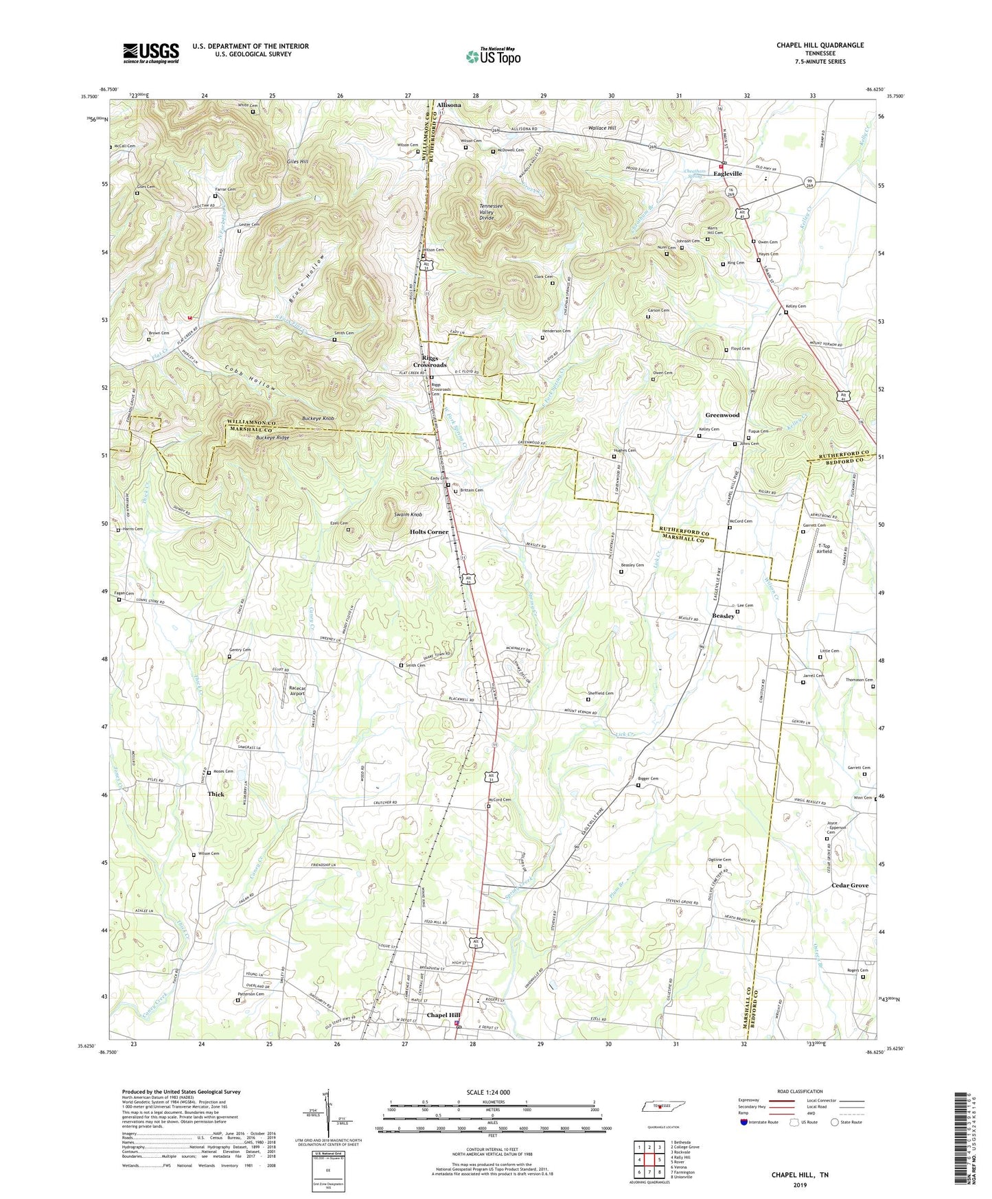
2022 topographic map quadrangle Chapel Hill in the state of Tennessee. Scale: 1:24000. Based on the newly updated USGS 7.5' US Topo map series, this map is in the following counties: Marshall, Rutherford, Williamson, Bedford. The map contains contour data, water features, and other items you are used to seeing on USGS maps, but also has updated roads and other features. This is the next generation of topographic maps. Printed on high-quality waterproof paper with UV fade-resistant inks.
Quads adjacent to this one:
West: Rally Hill
Northwest: Bethesda
North: College Grove
Northeast: Rockvale
East: Rover
Southeast: Unionville
South: Farmington
Southwest: Verona
This map covers the same area as the classic USGS quad with code o35086f6.
Contains the following named places: Beasley, Beasley Cemetery, Bigger Cemetery, Brittain Cemetery, Brown Cemetery, Bruce Hollow, Buckeye Knob, Buckeye Ridge, Carson Cemetery, Cedar Grove, Cedar Grove School, Chapel Hill, Chapel Hill Division, Chapel Hill Police Department, Chapel Hill Post Office, Chapel Hill Volunteer Fire Department, Cheatham Spring, City of Eagleville, Clark Cemetery, Cobb Hollow, Commissioner District 1, Eady Cemetery, Eagleville, Eagleville Baptist Church, Eagleville High School, Eagleville Post Office, Eagleville School, Eagleville Volunteer Fire Department, East Fork Spring Creek, Edwards Grove Church, Egypt Church, Ezell Cemetery, Fagan Cemetery, Farrar Cemetery, Flat Creek School, Floyd Cemetery, Forrest School, Fuqua Cemetery, Garrett Cemetery, Gentry Cemetery, Giles Cemetery, Giles Hill, Greenwood, Harris Cemetery, Hayes Cemetery, Henderson Cemetery, Hill Grove School, Holtland, Holtland School, Holts Corner, Holts Corner Baptist Church, Hughes Cemetery, Jarrell Cemetery, Johns Cemetery, Johnson Cemetery, Jones Creek, Joyce - Epperson Cemetery, Kelley Cemetery, Kelley Creek, King Cemetery, Lee Cemetery, Lester Cemetery, Lick Creek, Little Cemetery, Marrs Hill Cemetery, McCord Cemetery, McDowell Cemetery, Moses Cemetery, Mount Vernon Church, Mount Zion Church, North Fork Flat Creek, Nunn Cemetery, Ogilivie Cemetery, Owen Cemetery, Patterson Cemetery, Plum Branch, Racecar Airport, Riggs Chapel, Riggs Crossroads, Riggs Crossroads Cemetery, Rogers Cemetery, Sheffield Cemetery, Smith Cemetery, South Fork Flat Creek, Swaim Knob, Thick, Thick Creek, Thick School, Thomason Cemetery, Town of Chapel Hill, T-Top Airfield, Wallace Hill, West Fork Spring Creek, White Cemetery, Williamson Fire / Rescue - Flat Creek, Wilson Cemetery, Winn Crossing, ZIP Codes: 37034, 37060