MyTopo
Riceville Tennessee US Topo Map
Couldn't load pickup availability
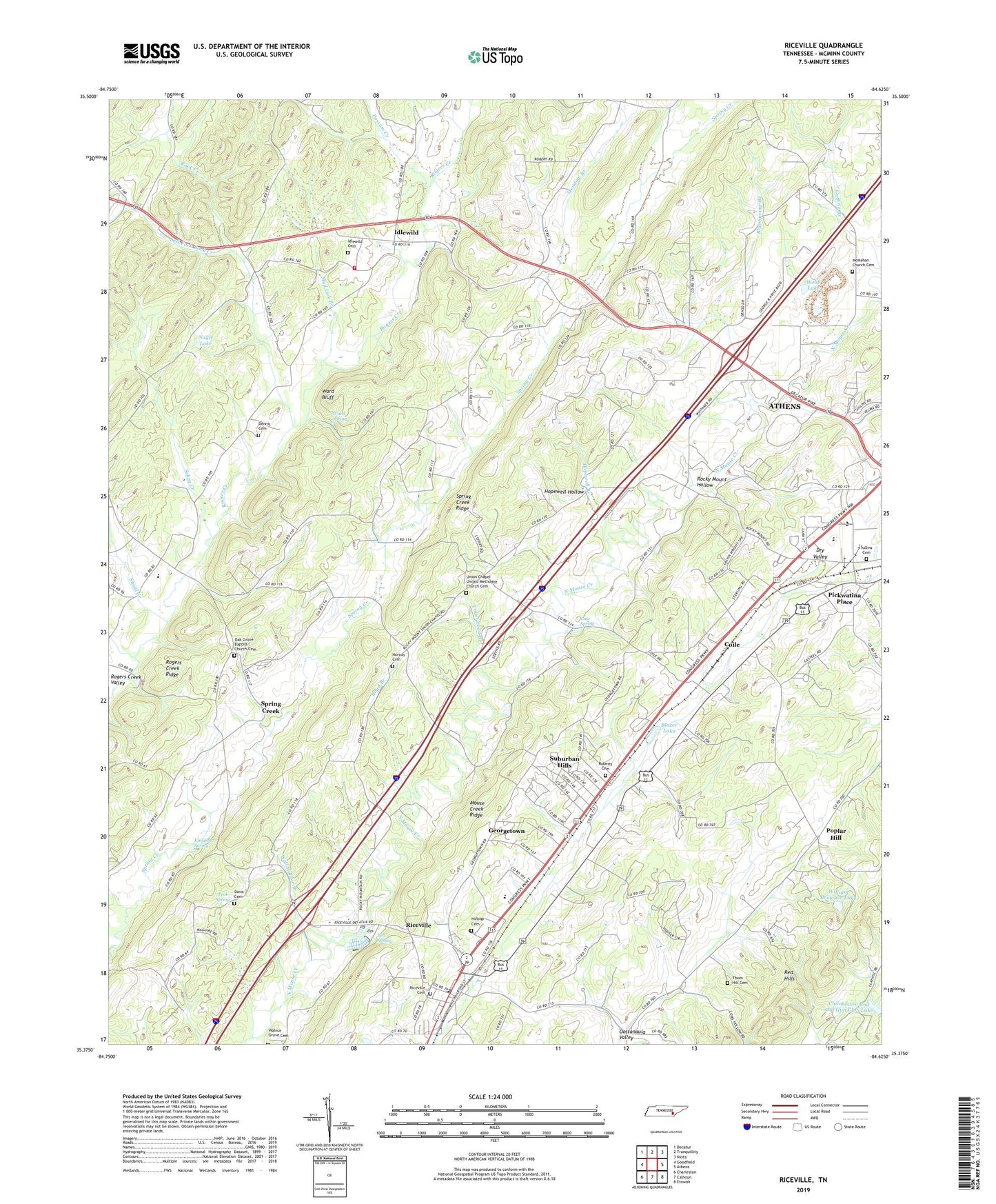
2022 topographic map quadrangle Riceville in the state of Tennessee. Scale: 1:24000. Based on the newly updated USGS 7.5' US Topo map series, this map is in the following counties: McMinn. The map contains contour data, water features, and other items you are used to seeing on USGS maps, but also has updated roads and other features. This is the next generation of topographic maps. Printed on high-quality waterproof paper with UV fade-resistant inks.
Quads adjacent to this one:
West: Goodfield
Northwest: Decatur
North: Tranquillity
Northeast: Niota
East: Athens
Southeast: Etowah
South: Calhoun
Southwest: Charleston
This map covers the same area as the classic USGS quad with code o35084d6.
Contains the following named places: Andrews Chapel, Bell Spring, Blazer Lake, Blue Spring Branch, Boyd Branch, Camp Ground School, Cate Spring, Chilohowee Rod and Gun Club Dam, Chilohowee Rod and Gun Club Lake, Clay Hill Church, Clay Hill School, Coile, Commissioner District 1, Davis Cemetery, Dennis Cemetery, Emmanuel Church, First Baptist Church, Georgetown, Hilltop Cemetery, Hilltop Church, Hopewell Branch, Hopewell Hollow, Horton Cemetery, Idlewild, Idlewild Baptist Church, Idlewild Cemetery, Idlewild Elementary School, Kinzalow Spring, Lakeview Church, Left Fork Rock Creek, McMahan Calvary Baptist Church Cemetery, McMahan Church, McMinn County District 7 Idlewild Rural Fire Department, Meadow Branch, Mine Road Landfill, Mount Lebanon School, Mount Zion Church, Mouse Creek Mill, Mouse Creek School, Mud Lick Branch, Nagle Lake, New Hopewell Church, Oak Grove Baptist Church, Oak Grove Baptist Church Cemetery, Peck Spring, Pickwatina Place, Pine Hill School, Poplar Hill, Poplar Hill School, Possum Creek, Red Hills, Riceville, Riceville Cemetery, Riceville Census Designated Place, Riceville Elementary School, Riceville Post Office, Riceville United Methodist Church, Roberts Cemetery, Rock Creek, Rocky Mount Church, Rocky Mount Hollow, Rocky Mount School, Rogers Creek Ridge, Rose Hill Church, Russell School, Shoal Creek, Sokey Creek, Spring Creek, Spring Creek Church, Spring Creek Ridge, State Area, Suburban Hills, Sullins Cemetery, Thorn Hill Cemetery, Underwood Branch, Union Chapel United Methodist Church, Union Chapel United Methodist Church Cemetery, Wall Hollow Branch, Walnut Grove Church, Ward Bluff, Ward Spring, Webb Lake, Westview Church, William Browder Dam, William Browder Lake, ZIP Code: 37303