MyTopo
Charleston Tennessee US Topo Map
Couldn't load pickup availability
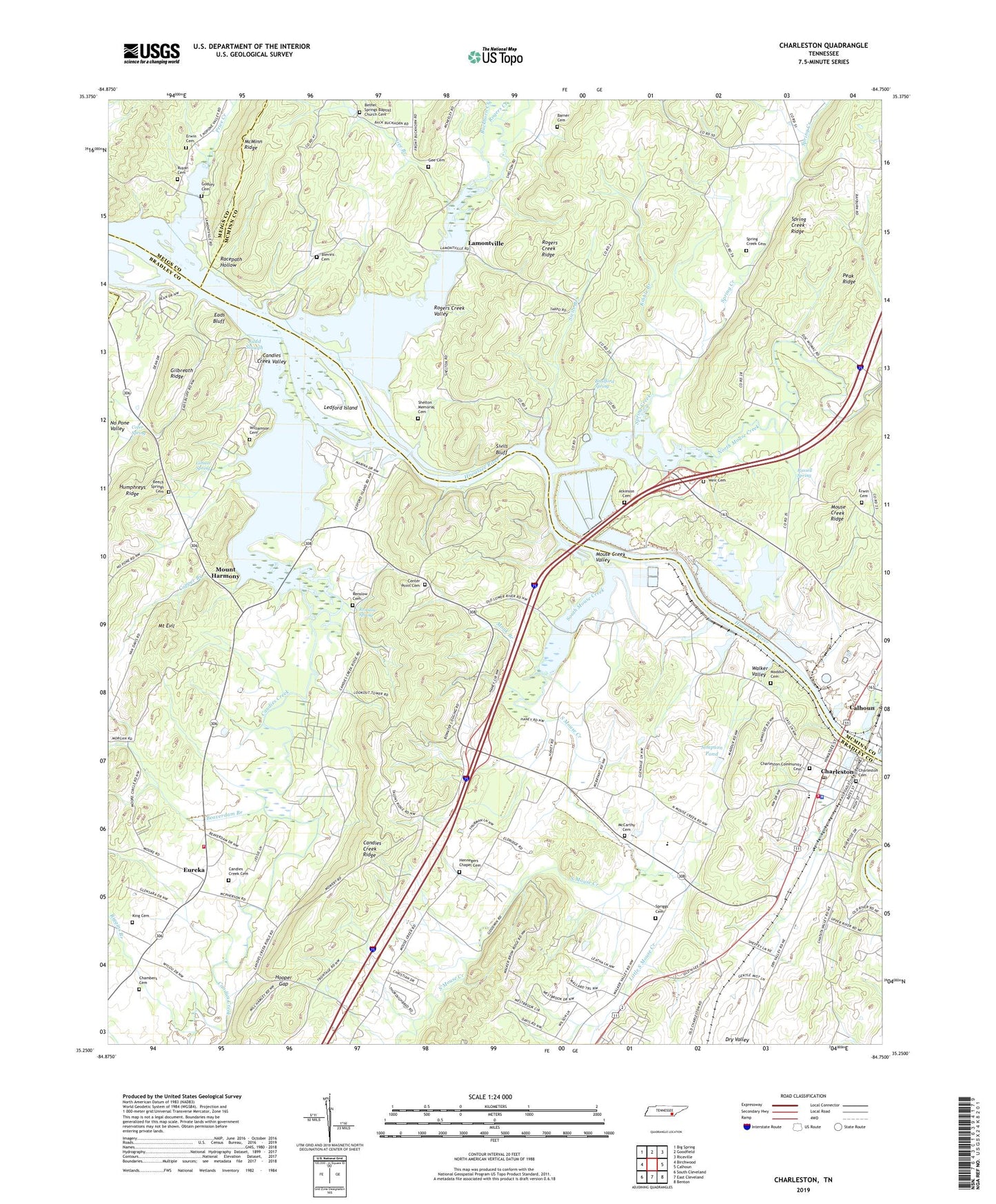
2022 topographic map quadrangle Charleston in the state of Tennessee. Scale: 1:24000. Based on the newly updated USGS 7.5' US Topo map series, this map is in the following counties: Bradley, McMinn, Meigs. The map contains contour data, water features, and other items you are used to seeing on USGS maps, but also has updated roads and other features. This is the next generation of topographic maps. Printed on high-quality waterproof paper with UV fade-resistant inks.
Quads adjacent to this one:
West: Birchwood
Northwest: Big Spring
North: Goodfield
Northeast: Riceville
East: Calhoun
Southeast: Benton
South: East Cleveland
Southwest: South Cleveland
This map covers the same area as the classic USGS quad with code o35084c7.
Contains the following named places: Abitibi - Bowater Emergency Response Team, Atkinson Cemetery, B and B Marina, Barner Cemetery, Beaverdam Branch, Beech Springs Cemetery, Bethel Springs Baptist Church, Bethel Springs Baptist Church Cemetery, Blevins Cemetery, Blevins Chapel, Bradford Spring, Bradley County Fire and Rescue Station 6 - Charleston, Bradley County Fire and Rescue Station 9 - Charleston, Buckhorn Creek, Camp Cherokee, Candies Creek, Candies Creek Baptist Church, Candies Creek Cemetery, Candies Creek Valley, Candies Creek Wildlife Management Area, Carriage Hills, Center Point Baptist Church, Center Point Cemetery, Chambers Cemetery, Charleston, Charleston Church of God, Charleston City Hall, Charleston Community Cemetery, Charleston Cumberland Presbyterian Church, Charleston Cumberland Presbyterian Church Cemetery, Charleston High School, Charleston Police Department, Charleston Post Office, City of Charleston, Cleveland Utilities Sewage Treatment Plant, Cofer Spring, Commissioner District 2, Copper Branch, Eads Bluff, Erwin Cemetery, Eureka, Eureka School, Gee Branch, Gee Cemetery, Gibson Spring, Gilbreath Ridge, Godsey Cemetery, Grays Ferry, Harbor Hills, Henegar Church, Hennegers Chapel Cemetery, High Point School, Hooper Gap, Hoopers Mill, Humphreys Ridge, Kibble Branch, King Cemetery, Lamontville, Lamontville Baptist Church, Lamontville School, Ledford Island, Little South Mouse Creek, Maddux Cemetery, Marina Hills, McCarthy Cemetery, Monk Branch, Monte Carlo Estates, Mount Evil, Mount Harmony, Mount Harmony School, Mouse Creek School, Mouse Creek Valley, North Mouse Creek, Peak Ridge, Price Creek, Racepath Hollow, Raht Ferry, Renslow Cemetery, Renslow Spring, Riggins Branch, Rogers Creek, Rogers Creek Valley, Rogers Creek Wildlife Management Area, Russell Spring, Ruyan Cemetery, Shelton Memorial Cemetery, Shelton Memorial Chapel, Simpson Pond, Sivils Bluff, Sivils Branch, South Mouse Creek, Spriggs Cemetery, Spring Creek, Spring Creek Cemetery, Spring Creek Church, Tillery Chapel School, Walker Valley, Walkers Ferry, Weir Cemetery, Williamson Cemetery, Wilson Heights