MyTopo
Excell Tennessee US Topo Map
Couldn't load pickup availability
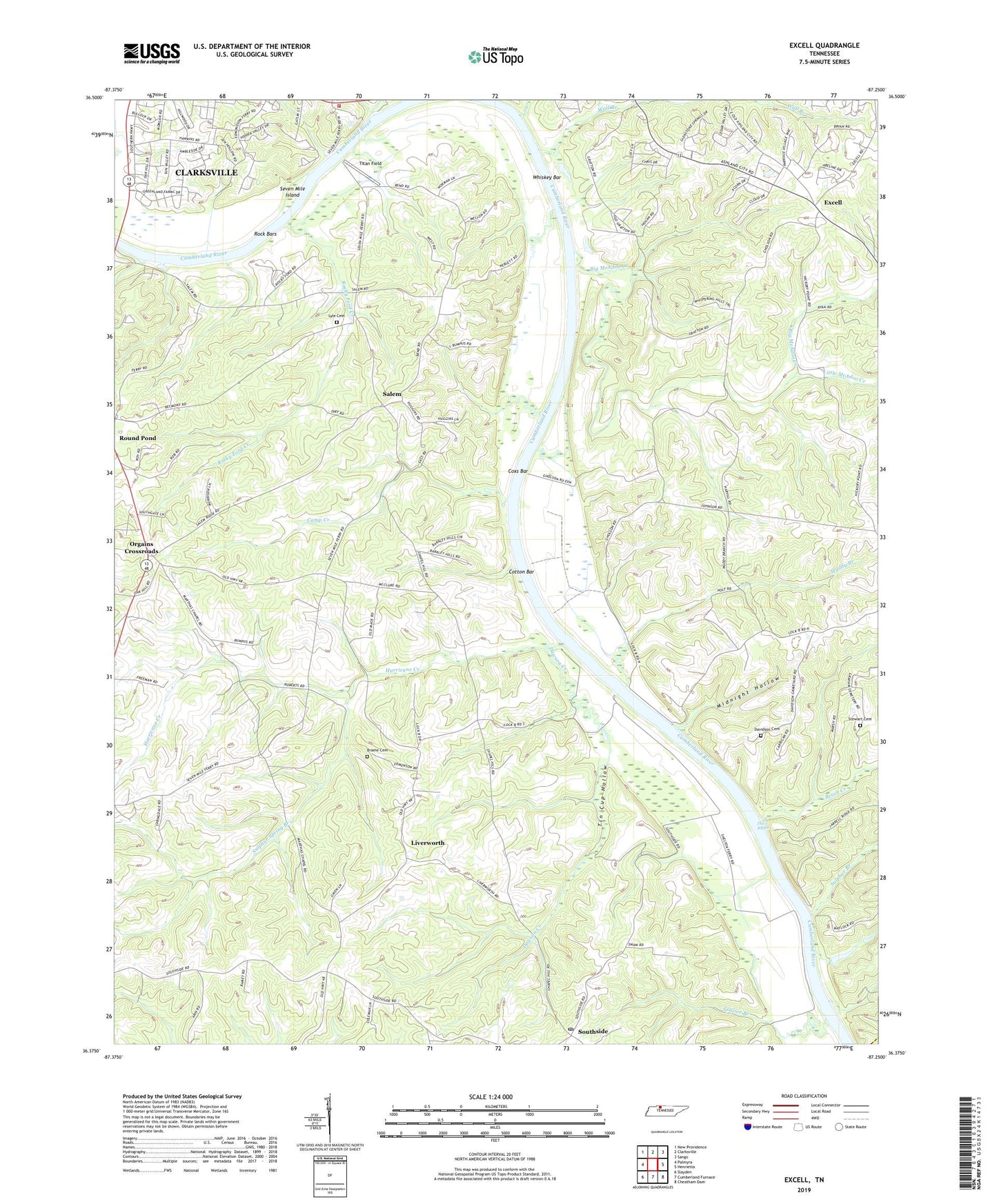
2022 topographic map quadrangle Excell in the state of Tennessee. Scale: 1:24000. Based on the newly updated USGS 7.5' US Topo map series, this map is in the following counties: Montgomery, Cheatham. The map contains contour data, water features, and other items you are used to seeing on USGS maps, but also has updated roads and other features. This is the next generation of topographic maps. Printed on high-quality waterproof paper with UV fade-resistant inks.
Quads adjacent to this one:
West: Palmyra
Northwest: New Providence
North: Clarksville
Northeast: Sango
East: Henrietta
Southeast: Cheatham Dam
South: Cumberland Furnace
Southwest: Slayden
This map covers the same area as the classic USGS quad with code o36087d3.
Contains the following named places: Bethlehem Church, Bethlehem School, Big McAdoo Creek, Brame Cemetery, Brush Creek, Burtons Landing, Cabin Row, Cabin Row Missionary Baptist Church, Camp Creek, Chapel Hill Church, Clarksville Boat Club, Clarksville Fire Rescue Department Station 4, Commissioner District 4, Cotton Bar, Coxs Bar, Cumberland Hills, Davidson Cemetery, Davidsons Landing, Davis Ripple, Dawson Creek, Deerfield, District 15, District 16, District 17, Dixon School, Edmondsons Ferry, Excell, Excell Baptist Church, Forest Acres, Frazier Branch, Glenstone, Grantville, Gratton Station, Greenland Farms, Hagewood Chapel, Harmon School, Harris Landing, Hickory Point School, Hollingsworth Landing, Hurricane Creek, Kingsbury, Lakeside Estates, Lime Kiln Landing, Little McAdoo Creek, Liverworth, Lock B, Lyle Cemetery, Marthas Chapel, Medallion Acres, Midnight Hollow, Mount Herman Christian Methodist Episcopal Church, Muddy Branch, Neblets Landing, Old Lock and Dam B, Orgains Crossroads, Rock Bars, Rocky Ford Creek, Rotary Hills, Round Pond School, Salem, Salem Field Airport, Salem School, Salem United Methodist Church, Seven Mile Ferry, Seven Mile Island, Sheltons Landing, Southern View, Southside Post Office, Southside School, Stewart Cemetery, Sulphur Branch, Sulphur Spring Branch, Sulphur Spring Church, Taylors Landing, Tin Cup Hollow, Titan Field, Wall Branch, Washington Furnace, Whiskey Bar, Wilsons Landing, Woodridge Estates