MyTopo
Smartt Mountain Tennessee US Topo Map
Couldn't load pickup availability
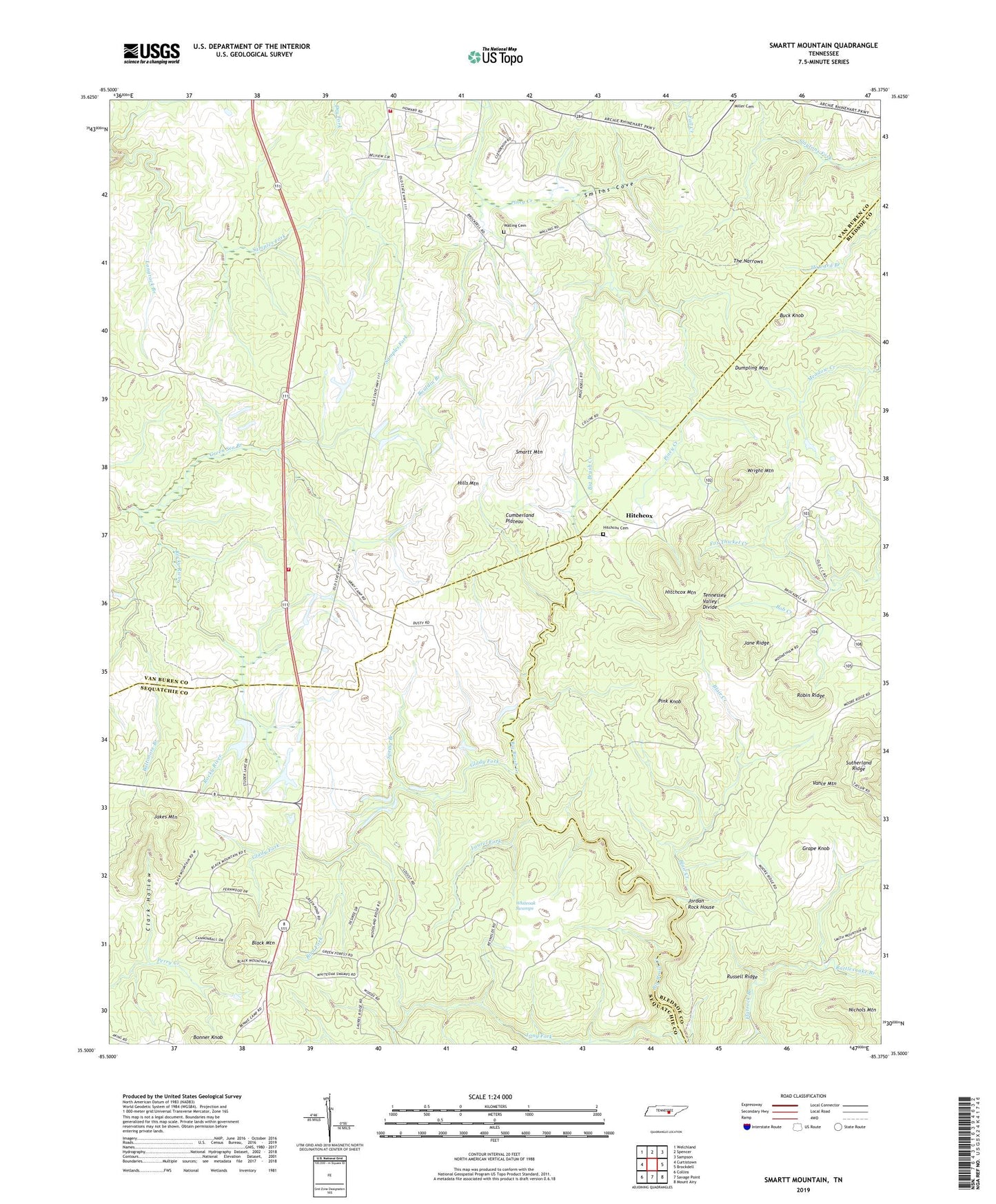
2019 topographic map quadrangle Smartt Mountain in the state of Tennessee. Scale: 1:24000. Based on the newly updated USGS 7.5' US Topo map series, this map is in the following counties: Van Buren, Bledsoe, Sequatchie. The map contains contour data, water features, and other items you are used to seeing on USGS maps, but also has updated roads and other features. This is the next generation of topographic maps. Printed on high-quality waterproof paper with UV fade-resistant inks.
Quads adjacent to this one:
West: Curtistown
Northwest: Welchland
North: Spencer
Northeast: Sampson
East: Brockdell
Southeast: Mount Airy
South: Savage Point
Southwest: Collins
Contains the following named places: Baltimore Branch, Bellview Church, Bird Fork, Black Mountain, Blair Creek, Bob Creek, Bonner Knob, Bouldin Branch, Buck Knob, Clark Hollow, Dumpling Mountain, Glady Fork, Grape Knob, Green Sea Branch, Hills Mountain, Hitchcox, Hitchcox Cemetery, Hitchcox Mountain, Jakes Mountain, Jane Ridge, Jordan Rock House, Laurel Fork, Long Fork, Longrock Branch, Olio, Piney Volunteer Fire Department Station 1, Piney Volunteer Fire Department Station 2, Pink Knob, Rattlesnake Branch, Robin Ridge, Russell Ridge, Smartt Mountain, Smartt Mountain Mine, Smiths Cove, Spring Branch, Studer Lake, Studer Lake Dam, Sutherland Ridge, The Narrows, Vance Mountain, Walling Cemetery, Whiteoak Swamps, Wright Mountain, ZIP Code: 38585