MyTopo
Sampson Tennessee US Topo Map
Couldn't load pickup availability
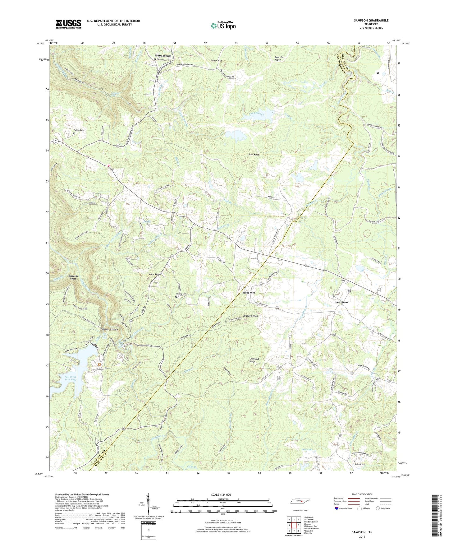
2022 topographic map quadrangle Sampson in the state of Tennessee. Scale: 1:24000. Based on the newly updated USGS 7.5' US Topo map series, this map is in the following counties: Van Buren, Bledsoe. The map contains contour data, water features, and other items you are used to seeing on USGS maps, but also has updated roads and other features. This is the next generation of topographic maps. Printed on high-quality waterproof paper with UV fade-resistant inks.
Quads adjacent to this one:
West: Spencer
Northwest: Bald Knob
North: Lonewood
Northeast: Herbert Domain
East: Billingsley Gap
Southeast: Pikeville
South: Brockdell
Southwest: Smartt Mountain
This map covers the same area as the classic USGS quad with code o35085f3.
Contains the following named places: Anderson Mine, Back Creek, Bald Knob, Bear Hollow Branch, Bear Pan Ridge, Big Hill Branch, Big Ivy Branch, Bledsoe County Correctional Complex, Bradden Creek, Bradden Knob, Buzzards Roost, Camp Creek, Cane Creek Falls, Chestnut Ridge, Commissioner District 3, Cumberland Plateau Division, DeBord Cemetery, Fall Creek, Fall Creek Falls, Fall Creek Falls Lake, Fall Creek Falls Lake Dam, Fall Creek Falls State Park, Fall Creek Falls Volunteer Fire Department, Flat Creek, Group Camp 1, Guy Mine, Harrison Gulf Branch, Haston Mine, Hemlock Falls, Jack Branch, Joe Branch, Johnnie Branch, Kellog Knob, Little Fall Creek, Long Branch, Meadow Creek, Mill Branch, Mill Creek, Mitchell Branch, Mooneyham, Mooneyham Cemetery, Mooneyham Division, Mooneyham School, Mount Della Church, Mount View Church, New Martin School, Pendergrass Mine, Pilot Ridge, Pine Lake, Pine Lake Dam, Piney Creek, Rockhouse Creek, Salzer Mountain, Sampson, Sampson School, Sandy Branch, Walling Cemetery, Walling Mill Creek, Watson Mine, Whiteside Branch