MyTopo
Spencer Tennessee US Topo Map
Couldn't load pickup availability
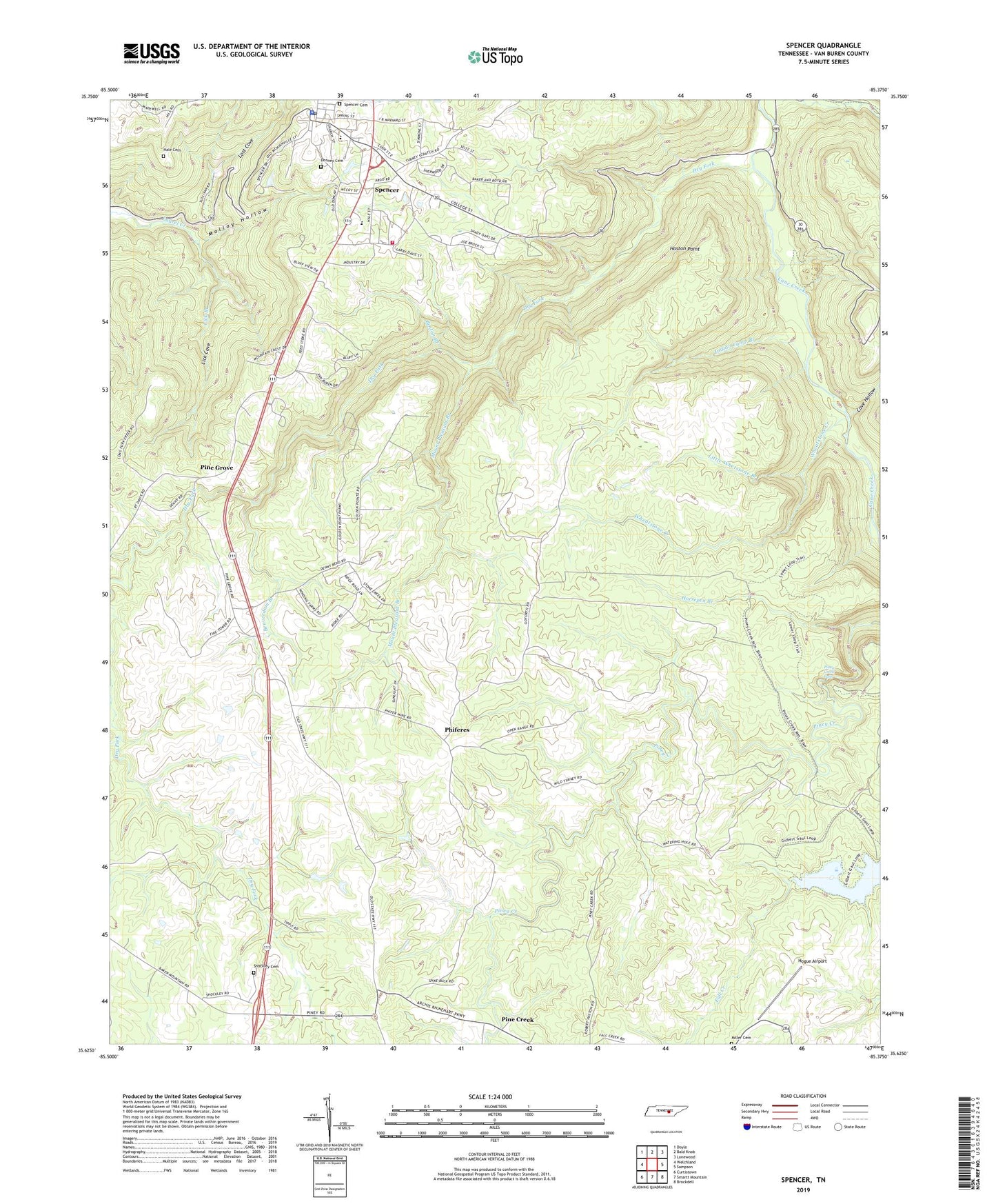
2019 topographic map quadrangle Spencer in the state of Tennessee. Scale: 1:24000. Based on the newly updated USGS 7.5' US Topo map series, this map is in the following counties: Van Buren. The map contains contour data, water features, and other items you are used to seeing on USGS maps, but also has updated roads and other features. This is the next generation of topographic maps. Printed on high-quality waterproof paper with UV fade-resistant inks.
Quads adjacent to this one:
West: Welchland
Northwest: Doyle
North: Bald Knob
Northeast: Lonewood
East: Sampson
Southeast: Brockdell
South: Smartt Mountain
Southwest: Curtistown
Contains the following named places: Beaverdam Branch, Benton Branch, Bethlehem Church, Cave Hollow, Commissioner District 4, Commissioner District 5, Dry Fork, Gillentine, Hale Cemetery, Haston Point, Hogue Airport, Horsepen Branch, Indian Camp Branch, Lick Branch, Lick Cove, Little Whetstone Branch, Lost Cove, Miller Cemetery, Molloy Cemetery, Molloy Hollow, Mount Pleasant Branch, Phiferes, Pine Creek, Pine Creek School, Pine Grove, Pine Grove School, Piney Church of Christ, Piney Creek Falls, Piney School, Rigby Number One Mine, Shockley Cemetery, Shockley Church, Shockleys Chapel School, Spencer, Spencer Division, Spencer Elementary School, Spencer Post Office, Spencer Town Cemetery, Spencer Volunteer Fire Department, Town of Spencer, Van Buren County, Van Buren County Courthouse, Van Buren County Sheriff's Office, Welchland Division, Whetstone Creek