MyTopo
Bald Knob Tennessee US Topo Map
Couldn't load pickup availability
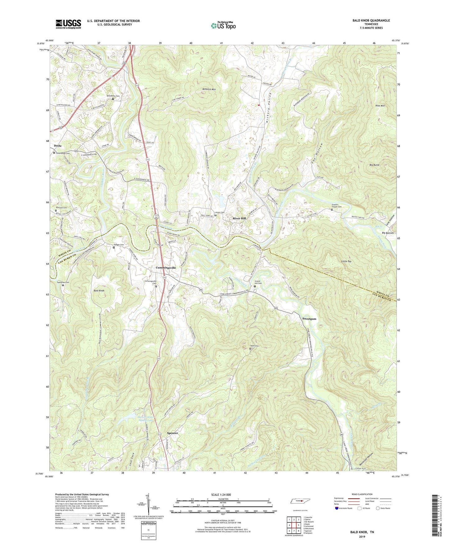
2022 topographic map quadrangle Bald Knob in the state of Tennessee. Scale: 1:24000. Based on the newly updated USGS 7.5' US Topo map series, this map is in the following counties: Van Buren, White. The map contains contour data, water features, and other items you are used to seeing on USGS maps, but also has updated roads and other features. This is the next generation of topographic maps. Printed on high-quality waterproof paper with UV fade-resistant inks.
Quads adjacent to this one:
West: Doyle
Northwest: Cassville
North: Sparta
Northeast: De Rossett
East: Lonewood
Southeast: Sampson
South: Spencer
Southwest: Welchland
This map covers the same area as the classic USGS quad with code o35085g4.
Contains the following named places: Bald Knob, Bethlehem Cemetery, Bethlehem Church, Big Butte, Calfkiller River, Camps Gulf Branch, Cane Creek, Cane Creek Church, Cane Hollow, Cave, Commissioner District 1, Cummings Cove Branch, Cummingsville, Cummingsville School, Cummingsville United Methodist Church Cemetery, Double Bridges, Dry Creek, Fox Hollow, Frasers Chapel United Methodist Church Cemetery, Frazer Chapel, Gravel Hill Cemetery, Greenwood, Greenwood Cemetery, Greenwood Church, Haston Chapel, Hickory Valley, Hickory Valley Branch, Hickory Valley Church, Hickory Valley Fire and Rescue, Hickory Valley School, Hodge Ferry, Hodges Cemetery, Little Top, Meade, Milksick Mountain, Millstone Branch, Old Bethel Church, Old Union Cemetery, Old Union Cumberland Presbyterian Church, Perry Branch, Pine Mountain, Plumlees Ford, River Hill, River Hill Ferry, River Hill Ford, Skurlock Cemetery, Sparkman Cemetery, Spencer Water Supply Dam, Spencer Water Supply Lake, Spring Branch School, Sweetgum, Turkey Cot Cove, Van Buren County Ambulance Service, Van Buren County High School, Waterfall Hollow, Yates Cemetery, Young