MyTopo
Lonewood Tennessee US Topo Map
Couldn't load pickup availability
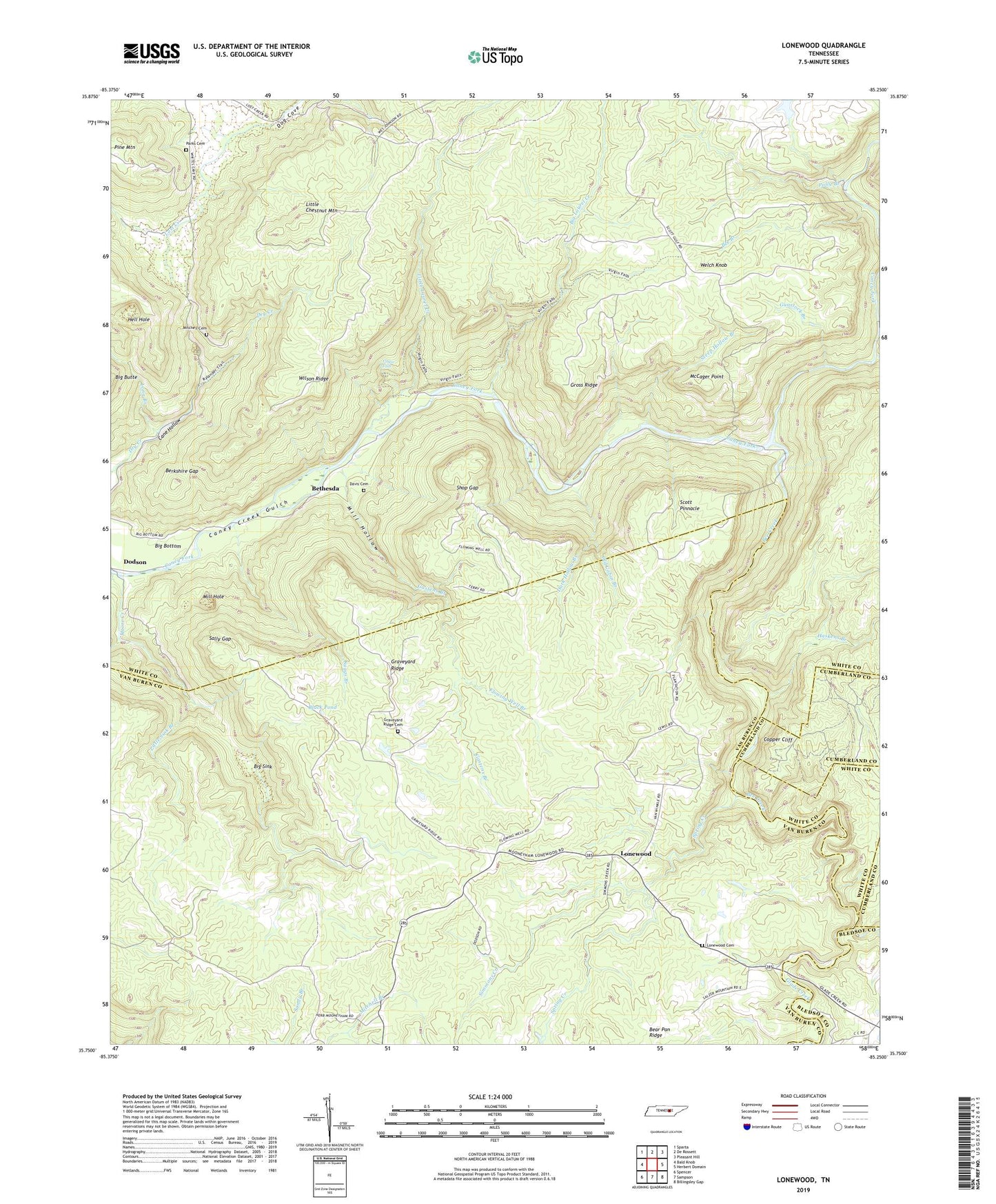
2022 topographic map quadrangle Lonewood in the state of Tennessee. Scale: 1:24000. Based on the newly updated USGS 7.5' US Topo map series, this map is in the following counties: White, Van Buren, Cumberland, Bledsoe. The map contains contour data, water features, and other items you are used to seeing on USGS maps, but also has updated roads and other features. This is the next generation of topographic maps. Printed on high-quality waterproof paper with UV fade-resistant inks.
Quads adjacent to this one:
West: Bald Knob
Northwest: Sparta
North: De Rossett
Northeast: Pleasant Hill
East: Herbert Domain
Southeast: Billingsley Gap
South: Sampson
Southwest: Spencer
This map covers the same area as the classic USGS quad with code o35085g3.
Contains the following named places: Bee Branch, Bee Creek, Berkshire Gap, Bethesda, Big Bottom, Big Laurel Creek, Big Sink, Black Pond, Caney Creek Gulch, Cedar Shoals Ford, Copper Cliff, Dark Hollow Branch, Davis Cemetery, Dodson, Dog Cove, Flowing Well Branch, Gastens Branch, Glade Creek, Graveyard Ridge, Graveyard Ridge Cemetery, Gross Ridge, Gunstock Branch, Haskens Branch, Hell Hole, Keener Branch, Little Chestnut Mountain, Little Laurel Creek, Little Sink Branch, Lonewood, Lonewood Cemetery, Lonewood School, Long Branch, Lost Creek, McCager Point, Mill Hole, Mill Hollow, Mitchell Cemetery, Moore Creek, Old Cabin Branch, Parks Cemetery, Polly Branch, Sally Gap, Scott Gulf, Scott Pinnacle, Shop Gap, Simmons Creek, Spring Creek, Steep Hollow Branch, Suggs Branch, Virgin Falls, Virgin Falls State Natural Area, Welch Knob, Wilson Ridge, Woodard Hankins Mine