MyTopo
Trezevant West Tennessee US Topo Map
Couldn't load pickup availability
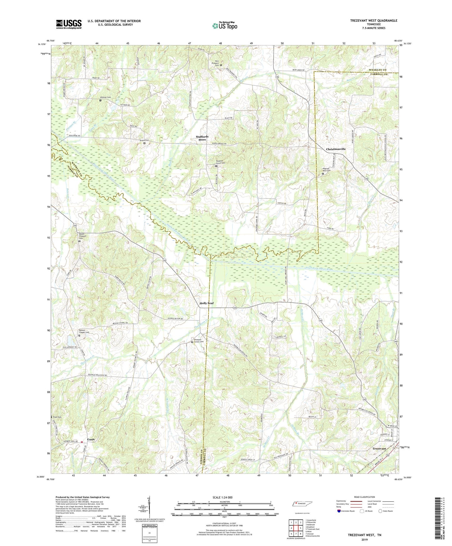
2019 topographic map quadrangle Trezevant West in the state of Tennessee. Scale: 1:24000. Based on the newly updated USGS 7.5' US Topo map series, this map is in the following counties: Carroll, Weakley, Gibson. The map contains contour data, water features, and other items you are used to seeing on USGS maps, but also has updated roads and other features. This is the next generation of topographic maps. Printed on high-quality waterproof paper with UV fade-resistant inks.
Quads adjacent to this one:
West: Bradford
Northwest: Greenfield
North: Pillowville
Northeast: McKenzie
East: Trezevant East
Southeast: McLemoresville
South: Atwood
Southwest: Milan
Contains the following named places: Austin Hank Lake, Austin Hank Lake Dam, Bear Creek, Belews Chapel Cemetery, Belews Church, Brock Cemetery, Cane Branch, Christmasville, DeMoss Branch, DeMoss Creek, Dinwiddie Store, District 15, District 2, District 3, Dolan Creek, Flippen School, Gann, Gann School, Gibson County Fire Department Station 4 Gann, Holly Leaf, Holt School, Mount Aries School, Mount Pleasant Cemetery, Mount Pleasant Church, Mount Zion Church of Christ, New Prospect Cemetery, New Prospect Church, Oak Grove School, Oak Hill School, Pilgrims Church, Pilgrims Rest Cemetery, Pittman Branch, Pittman Cemetery, Pittman School, Pleasant Green Cemetery, Pleasant Green Church, Pleasant Grove Baptist Church, Pleasant Grove Cemetery, Plum Creek, Pratt Cemetery, Pratt Church, Republican Grove Missionary Baptist Church, Short Branch, Smiths Chapel School, Staffords Store, Thompson Branch, Thompson Creek