MyTopo
McLemoresville Tennessee US Topo Map
Couldn't load pickup availability
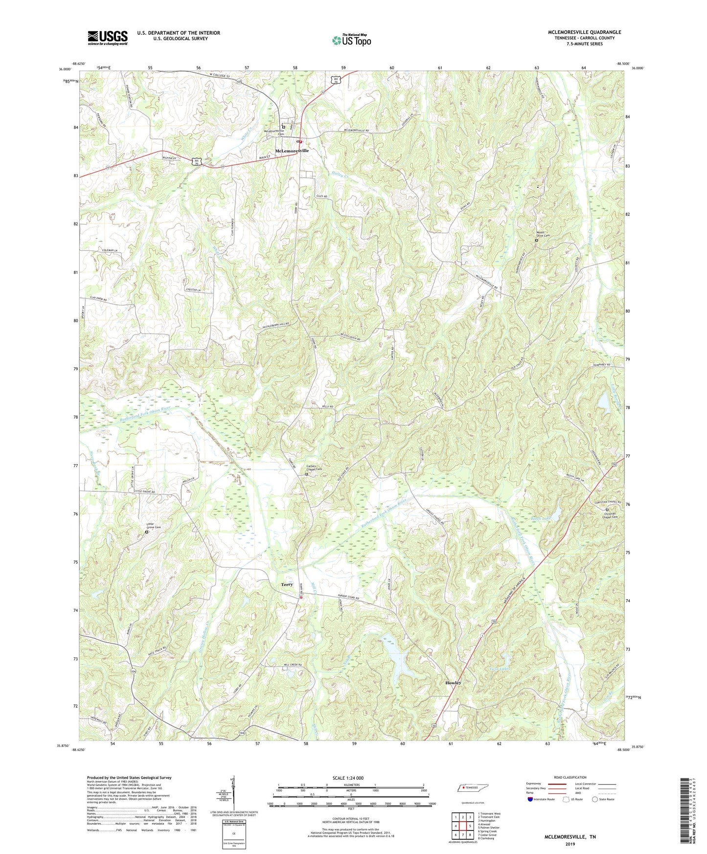
2022 topographic map quadrangle McLemoresville in the state of Tennessee. Scale: 1:24000. Based on the newly updated USGS 7.5' US Topo map series, this map is in the following counties: Carroll. The map contains contour data, water features, and other items you are used to seeing on USGS maps, but also has updated roads and other features. This is the next generation of topographic maps. Printed on high-quality waterproof paper with UV fade-resistant inks.
Quads adjacent to this one:
West: Atwood
Northwest: Trezevant West
North: Trezevant East
Northeast: Huntingdon
East: Palmer Shelter
Southeast: Clarksburg
South: Cedar Grove
Southwest: Spring Creek
This map covers the same area as the classic USGS quad with code o35088h5.
Contains the following named places: Beech Dam, Beech Lake, Carroll County Farm, Carroll County Rural Fire Department District 11 McLemoresville, Carroll County Rural Fire Department District 17 Terry, Carter Chapel, Carters Chapel, Carters Chapel Cemetery, Christian Chapel, Christian Chapel Cemetery, Commissioner District 1, Cool Springs Church, District 5, District 8, Full Gospel Mission, Gin Branch, Grassy Hollow Creek, Holmes Store, Howley, Howley School, Little Grove Cemetery, Little Grove Church, Little Reedy Creek, McLemoresville, McLemoresville Baptist Church, McLemoresville Cemetery, McLemoresville Collegiate Institute, McLemoresville Post Office, McLemoresville School, Mill Creek, Mount Olive Cemetery, Nat Branch, New Reedy Creek Church, Obion Chapel, Reedy Creek Baptist Church, Robert Haney Dam, Robert Haney Lake, Terry, Terry School, Town of McLemoresville, Trezevant Division, True Tabernacle, Twin Lakes, Westview School, ZIP Code: 38235