MyTopo
Atwood Tennessee US Topo Map
Couldn't load pickup availability
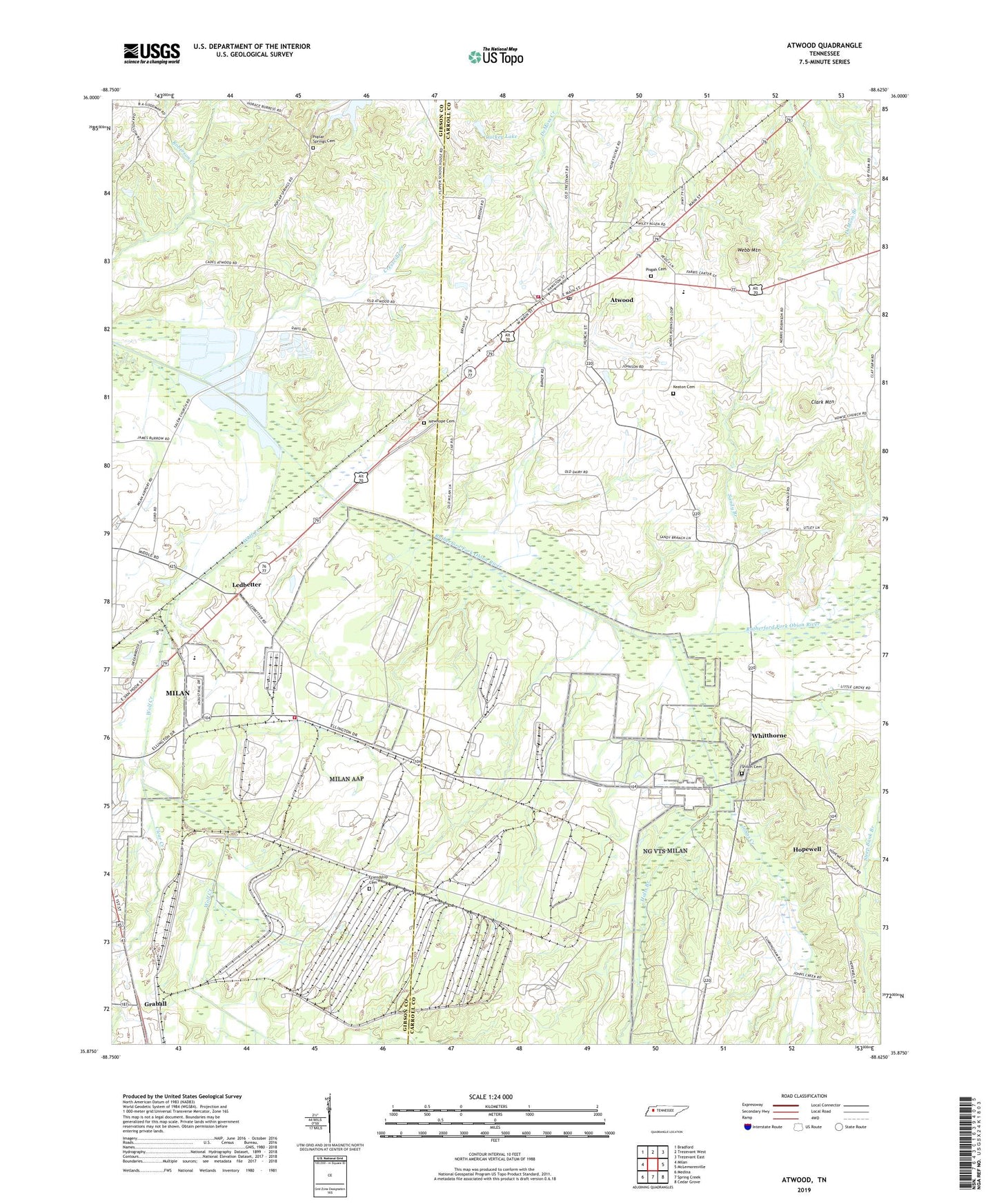
2022 topographic map quadrangle Atwood in the state of Tennessee. Scale: 1:24000. Based on the newly updated USGS 7.5' US Topo map series, this map is in the following counties: Carroll, Gibson. The map contains contour data, water features, and other items you are used to seeing on USGS maps, but also has updated roads and other features. This is the next generation of topographic maps. Printed on high-quality waterproof paper with UV fade-resistant inks.
Quads adjacent to this one:
West: Milan
Northwest: Bradford
North: Trezevant West
Northeast: Trezevant East
East: McLemoresville
Southeast: Cedar Grove
South: Spring Creek
Southwest: Medina
This map covers the same area as the classic USGS quad with code o35088h6.
Contains the following named places: Atwood, Atwood First Baptist Church, Atwood Junior High School, Atwood Post Office, Atwood Volunteer Fire Department, Brick Hill School, Bryant Chapel, Bryant Chapel School, Clark Mountain, Clear Creek, Commissioner District 12, Commissioner District 15, Cressville Creek, Creswell Lake Number Thirty-eight, Creswell Lake Number Thirty-eight Dam, Creswell Lake Number Thirty-five, Creswell Lake Number Thirty-five Dam, Creswell Lake Number Thirty-four, Creswell Lake Number Thirty-four Dam, Creswell Lake Number Thirty-one, Creswell Lake Number Thirty-one Dam, Creswell Lake Number Thirty-three, Creswell Lake Number Thirty-three Dam, Creswell Lake Number Thirty-two, Creswell Lake Number Thirty-two Dam, Creswell Lake Number Twenty-eight, Creswell Lake Number Twenty-eight Dam, Creswell Lake Number Twenty-five, Creswell Lake Number Twenty-five Dam, Creswell Lake Number Twenty-four, Creswell Lake Number Twenty-four Dam, Creswell Lake Number Twenty-nine, Creswell Lake Number Twenty-nine Dam, Creswell Lake Number Twenty-one, Creswell Lake Number Twenty-one Dam, Creswell Lake Number Twenty-three, Creswell Lake Number Twenty-three Dam, Cunningham School, District 20, District 21, East Fork Wolf Creek, Fairview Church, Friendship Cemetery, Halls Branch, Hammond School, Hopewell, Hopewell Baptist Church, Houser School, Howse, Howse Baptist Church, Johns Creek, Keaton Cemetery, Ledbetter, Luckey Lake, Luckey Lake Dam, Milan Army Ammunition Plant, Milan Army Ammunition Plant Fire and Emergency Medical Service, Milan City Park, Milan Country Club, Milan High School, Milan Vocational-Technical School, Moore School, Mount Olive Church, MTA Junior High School, New Hope, New Hope Baptist Church, Newhope Cemetery, Pisgah Cemetery, Pisgah Presbyterian Church, Poplar Springs Cemetery, Poplar Springs Church, Rotary Field, Salem Church, Salem School, Sandy Branch, Shiloh Cemetery, Shiloh Church, Steep Bank Branch, Temple Church, Town of Atwood, University of Tennessee Agricultural Experimental Farm, Webb Mountain, West Fork Wolf Creek, Whitthorne, Wolf Creek, ZIP Code: 38220