MyTopo
Viola Tennessee US Topo Map
Couldn't load pickup availability
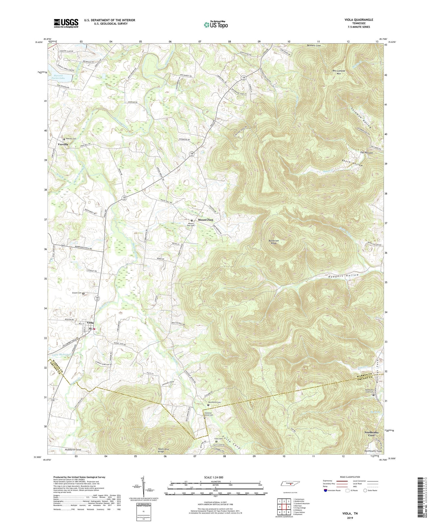
2019 topographic map quadrangle Viola in the state of Tennessee. Scale: 1:24000. Based on the newly updated USGS 7.5' US Topo map series, this map is in the following counties: Warren, Grundy. The map contains contour data, water features, and other items you are used to seeing on USGS maps, but also has updated roads and other features. This is the next generation of topographic maps. Printed on high-quality waterproof paper with UV fade-resistant inks.
Quads adjacent to this one:
West: Morrison
Northwest: Centertown
North: McMinnville
Northeast: Cardwell Mountain
East: Irving College
Southeast: Altamont
South: Cane Hollow
Southwest: Hillsboro
Contains the following named places: Bascom Cemetery, Bascom Church, Basham Field, Beech Hollow, Big Spring, Brookside School, Butterson Knob, Chestnut Grove, Chestnut Grove Cemetery, Chestnut Grove Church, Corinth School, Fultz Cemetery, Fultz Cove, Fultz Creek, Hanner Highland School and Female Academy, Harvest Farms Lake, Harvest Farms Lake Dam, Hubbard Cove, Keel Branch, Little Hickory Creek, Macedonia Cemetery, Morrison Division, Mount Olive Bridge, Mount Zion, Mount Zion Cemetery, Mount Zion School, Mount Zion United Methodist Church, Northcutts Cove, Northcutts Cove Cemetery, Northcutts Cove Church, Northcutts Cove School, Rockcliff Church, Rodgers Hollow, Smith Hollow, Solomon Hollow, The Narrows, Town of Viola, Vervilla, Viola, Viola Cemetery, Viola Church of Christ, Viola Elementary School, Viola Fire Department, Viola Post Office, Viola United Methodist Church, West Fork Hickory Creek, White Hall Church, ZIP Code: 37394