MyTopo
Cardwell Mountain Tennessee US Topo Map
Couldn't load pickup availability
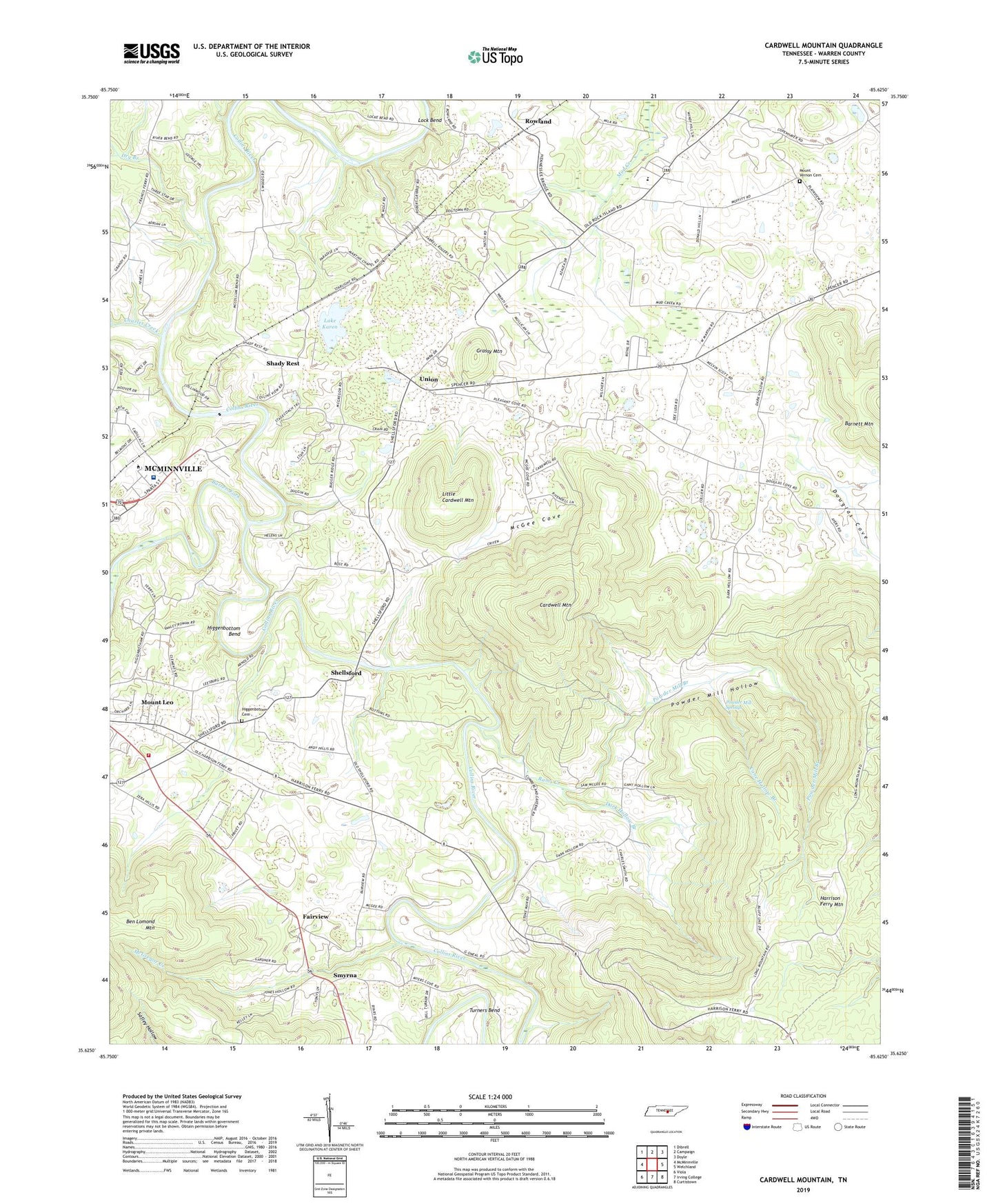
2022 topographic map quadrangle Cardwell Mountain in the state of Tennessee. Scale: 1:24000. Based on the newly updated USGS 7.5' US Topo map series, this map is in the following counties: Warren. The map contains contour data, water features, and other items you are used to seeing on USGS maps, but also has updated roads and other features. This is the next generation of topographic maps. Printed on high-quality waterproof paper with UV fade-resistant inks.
Quads adjacent to this one:
West: McMinnville
Northwest: Dibrell
North: Campaign
Northeast: Doyle
East: Welchland
Southeast: Curtistown
South: Irving College
Southwest: Viola
This map covers the same area as the classic USGS quad with code o35085f6.
Contains the following named places: Barren Fork, Bethlehem Church, Blacks Ferry, Blue Spring Cove, Cane Hollow Branch, Cardwell Mountain, Charles Creek, Collins River Volunteer Fire Department, Commissioner District 4, Commissioner District 5, Commissioner District 7, Dark Hollow Branch, Dark Hollow Church, Douglas Cove, Dry Branch, East Elementary School, Fairview, Grassy Mountain, Groves, Higgenbottom Bend, Higgenbottom Cemetery, Lake Karen, Leesburg Church, Left Fork Dry Branch, Little Cardwell Mountain, Lock Bend, Martins Chapel United Methodist Church, McGee Cove, McGregor Creek, McMinnville Quarry, Mount Vernon Cemetery, Mount Vernon Church, Mount View Church, Mud Creek, New Union United Methodist Church, Pleasant Cove Church, Pleasant Hill School, Powder Mill Branch, Powder Mill Hollow, Powder Mill Springs, Rams Creek, Right Fork Dry Branch, River Park Hospital, Rowland, Shady Rest, Shellsford, Shellsford Baptist Church, Shiloh Church, Smyrna, Smyrna Church of Christ, Three Star Mall Shopping Center, Turners Bend, Union, Warren County Ambulance Service, Warren County Farm, ZIP Code: 37110