MyTopo
New Middleton Tennessee US Topo Map
Couldn't load pickup availability
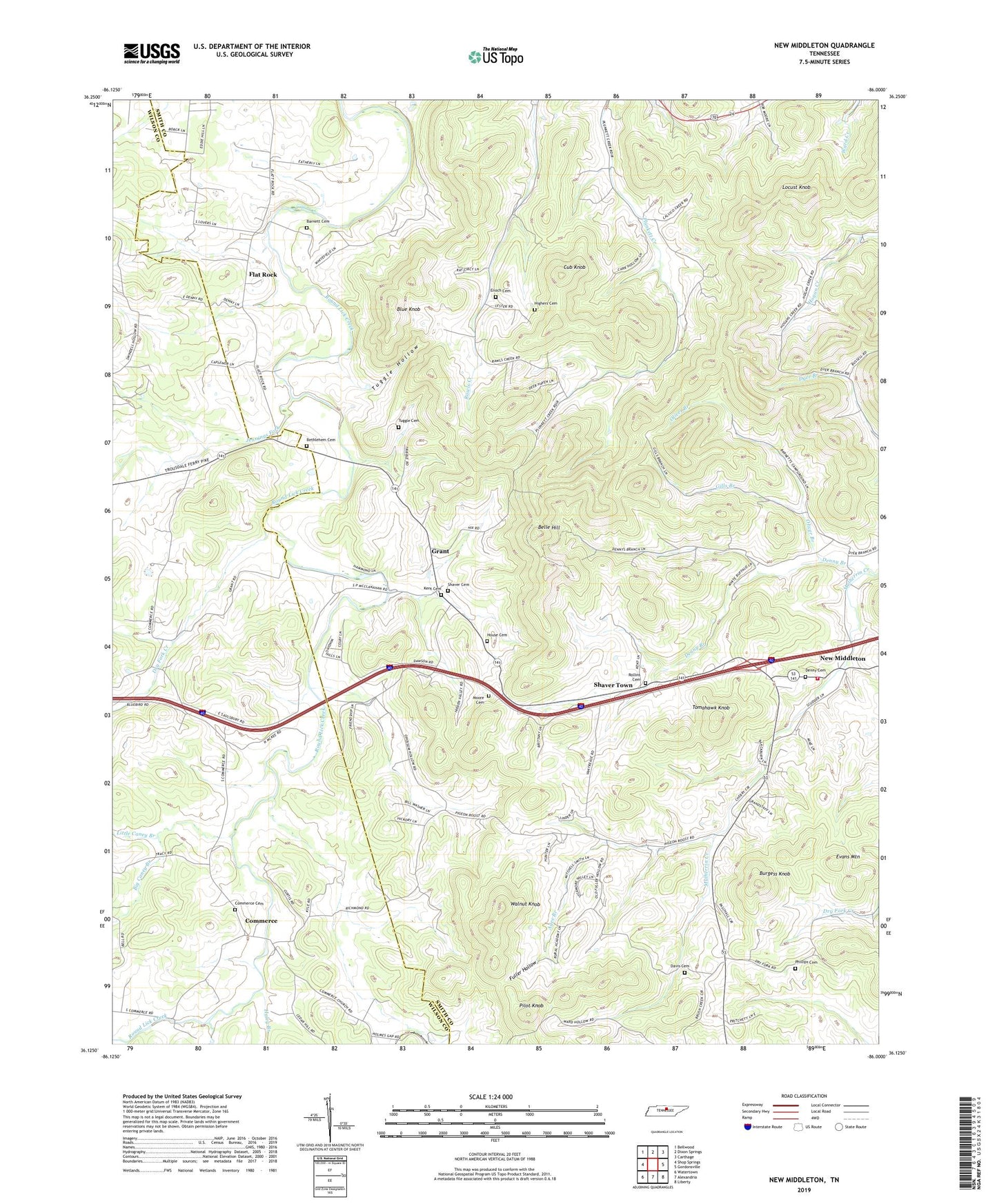
2022 topographic map quadrangle New Middleton in the state of Tennessee. Scale: 1:24000. Based on the newly updated USGS 7.5' US Topo map series, this map is in the following counties: Smith, Wilson. The map contains contour data, water features, and other items you are used to seeing on USGS maps, but also has updated roads and other features. This is the next generation of topographic maps. Printed on high-quality waterproof paper with UV fade-resistant inks.
Quads adjacent to this one:
West: Shop Springs
Northwest: Bellwood
North: Dixon Springs
Northeast: Carthage
East: Gordonsville
Southeast: Liberty
South: Alexandria
Southwest: Watertown
This map covers the same area as the classic USGS quad with code o36086b1.
Contains the following named places: Agee Branch, Barnett Cemetery, Belle Hill, Bethlehem Cemetery, Big Caney Branch, Blue Knob, Burgess Knob, Clinton College, Commerce, Commerce Cemetery, Commerce School, Commissioner District 3, Commissioner District 4, Cub Knob, Cumberland Church, Davis Cemetery, Denny Branch, Denny Cemetery, Dry Fork Creek, Enoch Cemetery, Evans Mountain, Flat Rock, Flat Rock Church of Christ, Fuller Hollow, Gills Branch, Good Hope Church, Grant, Grant Baptist Church, Grant Cemetery, Grant Church, Grant School, Haley Branch, Highers Cemetery, Holmes Gap School, House Cemetery, Jennings, Jennings Fork, Little Caney Branch, Locust Knob, Macedonia Baptist Church, Moore Cemetery, New Middleton, New Middleton Baptist Church, Oliver Branch, Phillips Cemetery, Pilot Knob, Rawls Creek Church, Rollins Cemetery, Saulsbury, Saulsbury Church, Shaver Cemetery, Shaver Town, Smith County Fire Department, Tomahawk Knob, Tuggle Cemetery, Tuggle Hollow, Walnut Knob, ZIP Codes: 38547, 38563