MyTopo
Whites Creek Tennessee US Topo Map
Couldn't load pickup availability
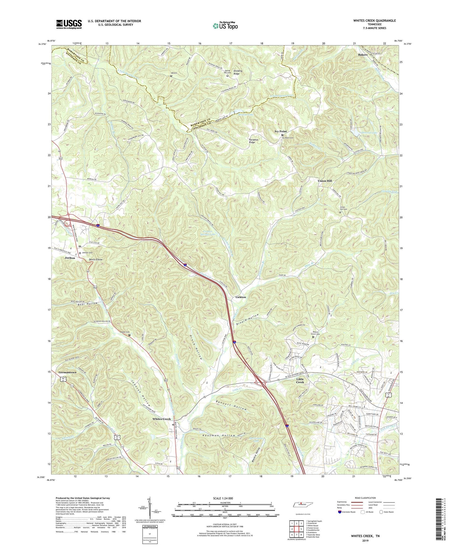
2019 topographic map quadrangle Whites Creek in the state of Tennessee. Scale: 1:24000. Based on the newly updated USGS 7.5' US Topo map series, this map is in the following counties: Davidson, Robertson. The map contains contour data, water features, and other items you are used to seeing on USGS maps, but also has updated roads and other features. This is the next generation of topographic maps. Printed on high-quality waterproof paper with UV fade-resistant inks.
Quads adjacent to this one:
West: Forest Grove
Northwest: Springfield South
North: Greenbrier
Northeast: White House
East: Goodlettsville
Southeast: Nashville East
South: Nashville West
Southwest: Scottsboro
Contains the following named places: Adcock, Alex Green Elementary School, Bakers, Beacon Baptist Church, Bear Hollow, Beech Grove Cemetery, Beech Grove Church, Bellshire, Bellshire Assembly of God Church, Bellshire Elementary School, Bellshire Shopping Center, Bellshire United Methodist Church, Bennett Hollow, Browns Lake, Browns Lake Dam, Carney Creek, Claylick Creek, Commissioner District 3, Community Baptist Church, Crocker Spring Branch, Crocker Springs Dam, Crocker Springs Lake, Cummings Branch, Dalemere, Devils Elbow, Dickerson Road Baptist Church, Dividing Ridge, Druard Hollow, Dry Fork, Dukes Cemetery, Earthman Fork, First Baptist Church of Joelton, Germantown, Gordons Store, High Point Store, Hunters Lane High School, Ivy Point, Ivy Point Cemetery, Ivy Point Church of Christ, Joelton, Joelton Air Force Station, Joelton Cemetery, Joelton Elementary School, Joelton Middle School, Joelton Post Office, Johnson Hollow, Kaufman Hollow, Lakewood Dam, Lakewood Lake, Lickton, Little Creek, Little Creek Community Center, Little Creek School, Living Water Ministries, Mackie Valley, New Wine Ministries, Oak Grove School, Paradise Ridge, Pathway Christian Center, Pioneer Christian Academy, Prock Hollow, Ridgepost, Shaw Branch, Sportsmans Lake, Sportsmans Lake Dam, Spring Hill Cemetery, Spring Hill Church, Strait Word Baptist Church, Sulphur Branch, The Carpenter Shop Church, Trantham Creek, Union Hill, Union Hill Cemetery, Union Hill Church, Union Hill School, Walkers Church, Weaver School, Whites Creek, Whites Creek Comprehensive High School, Whites Creek High School, Whites Creek Park, Whites Creek Post Office, Whites Creek Springs, Williams Hills, WLAC-AM (Nashville), WMAK-FM (Hendersonville), WTVF-TV (Nashville), ZIP Code: 37189