
MyTopo
Zionville Tennessee US Topo Map
Couldn't load pickup availability
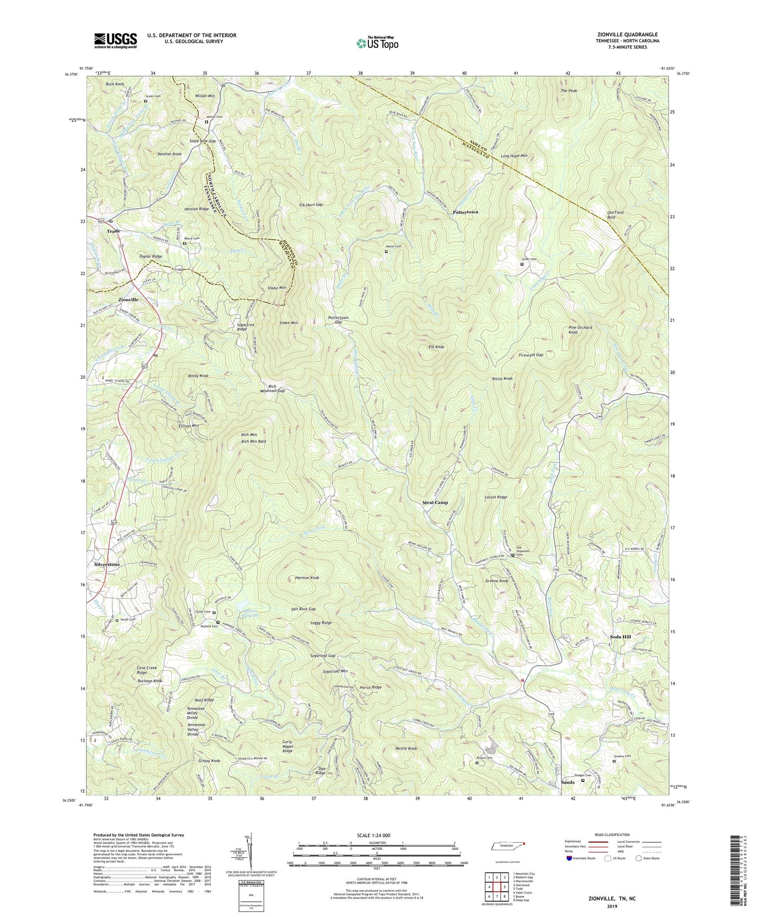
2022 topographic map quadrangle Zionville in the states of North Carolina, Tennessee. Scale: 1:24000. Based on the newly updated USGS 7.5' US Topo map series, this map is in the following counties: Johnson, Watauga, Ashe. The map contains contour data, water features, and other items you are used to seeing on USGS maps, but also has updated roads and other features. This is the next generation of topographic maps. Printed on high-quality waterproof paper with UV fade-resistant inks.
Quads adjacent to this one:
West: Sherwood
Northwest: Mountain City
North: Baldwin Gap
Northeast: Warrensville
East: Todd
Southeast: Deep Gap
South: Boone
Southwest: Valle Crucis
This map covers the same area as the classic USGS quad with code o36081c6.
Contains the following named places: Bethany Church, Brown Cemetery, Buck Knob, Buckeye Knob, Cobb Creek, Cove Creek Ridge, Culler Cemetery, Curly Mapel Ridge, Doe Branch, Doe Ridge Baptist Church, Elk Horn Gap, Elk Knob, Elk Knob Baptist Church, Elk Knob State Natural Area, Ellison Mountain, Firescald Gap, Friendship Methodist Church, Grassy Knob, Green Valley Elementary School, Greene Cemetery, Greene Knob, Greer Cemetery, Harmon Knob, Hessian Ridge, Hodges Cemetery, Hopewell Methodist Church, Jenkins Creek, Jones Branch, Little Creek, Locust Ridge, Loggy Ridge, Long Hope Mountain, Maine Branch, Maine Cemetery, McBrides Mill, Meat Camp, Meat Camp Baptist Church, Meat Camp Church, Meat Camp Fire Department, Middle Fork Drake Branch, Mine Branch, Mount Pleasant Lutheran Church, Mount Zion Church, Nettle Knob, Norris, Norris Fork, North Fork Drake Branch, Old Field Bald, Old Hopewell Cemetery, Panther Knob, Pierce Ridge, Pine Orchard Knob, Pleasant Grove Baptist Church, Pleasant Valley Methodist Church, Poplar Ridge, Potato Hill, Potato Hill Lake, Pottertown, Pottertown Gap, Pottertown School, Proffit Grove Baptist Church, Reece Branch, Reece Family Cemetery, Rich Mountain, Rich Mountain Bald, Rich Mountain Baptist Church, Rich Mountain Gap, Rich Mountain School, Rittle Fork, Rittle Knob, Rocky Knob, Rush Branch, Salt Rock Gap, Sands, Skyland Cemetery, Smith Cemetery, Snake Mountain, Snyder Branch, Soda Hill, South Branch North Fork New River, South Fork Drake Branch, State Line Gap, Sugarloaf Gap, Sugarloaf Mountain, Sugartree Ridge, Sutherland Valley Church, Thomas Chapel, Thomas School, Township of Meat Camp, Township of North Fork, Trade, Trade Elementary School, Trade Post Office, Trivett Branch, Vanderpool Church, Wilson Cemetery, Winebarger Mill, Winebarger School, Wolf Ridge, Zionville, Zionville Baptist Church, Zionville Post Office, ZIP Code: 28698


