MyTopo
Adrian Texas US Topo Map
Couldn't load pickup availability
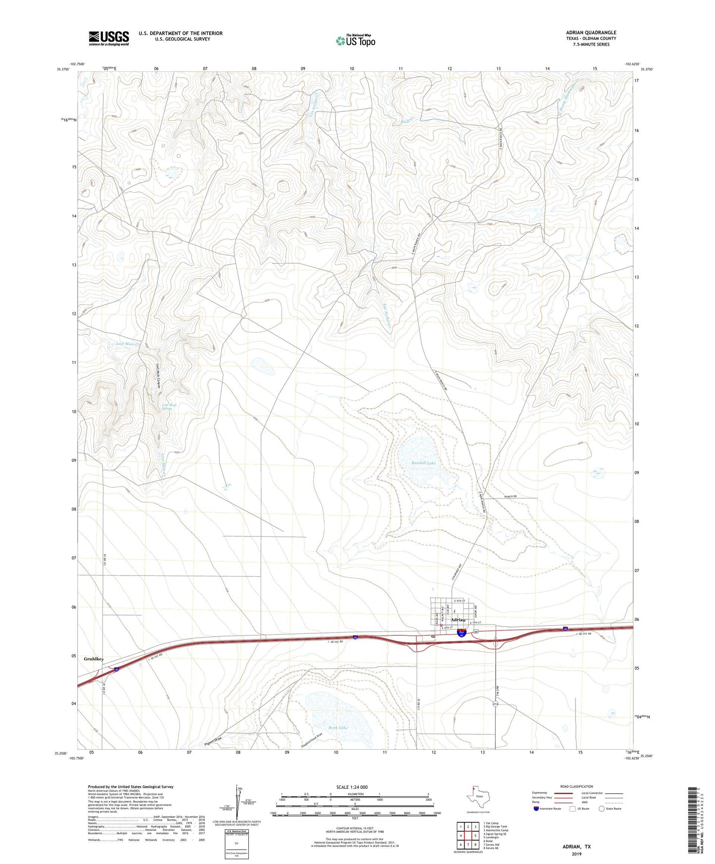
2022 topographic map quadrangle Adrian in the state of Texas. Scale: 1:24000. Based on the newly updated USGS 7.5' US Topo map series, this map is in the following counties: Oldham. The map contains contour data, water features, and other items you are used to seeing on USGS maps, but also has updated roads and other features. This is the next generation of topographic maps. Printed on high-quality waterproof paper with UV fade-resistant inks.
Quads adjacent to this one:
West: Signal Spring SE
Northwest: Vat Camp
North: Big George Tank
Northeast: Alamocitos Camp
East: Landergin
Southeast: Simms NE
South: Simms NW
Southwest: Boise
This map covers the same area as the classic USGS quad with code o35102c6.
Contains the following named places: Adrian, Adrian City Office, Adrian Emergency Medical Services, Adrian Post Office, Adrian Volunteer Fire Department, Big Dam Tank, Big Dam Tank Dam, City of Adrian, Cottonwood Windmill, Dead Man Windmill, Deep Windmill, East Adrian Windmill, East Headquarters Windmill, Gruhlkey, Hackberry Windmill, Lost Mule Canyon, Lost Mule Spring, Lost Mule Windmill, Pigpen Draw, Polar Bear Camp, Randall Lake, Randall Windmill, Rock Lake, Slaughterhouse Draw, West Adrian Windmill, West Headquarters Windmill, West Prong Windmill, White Knob Windmill, Wimberly Place