MyTopo
Anson Texas US Topo Map
Couldn't load pickup availability
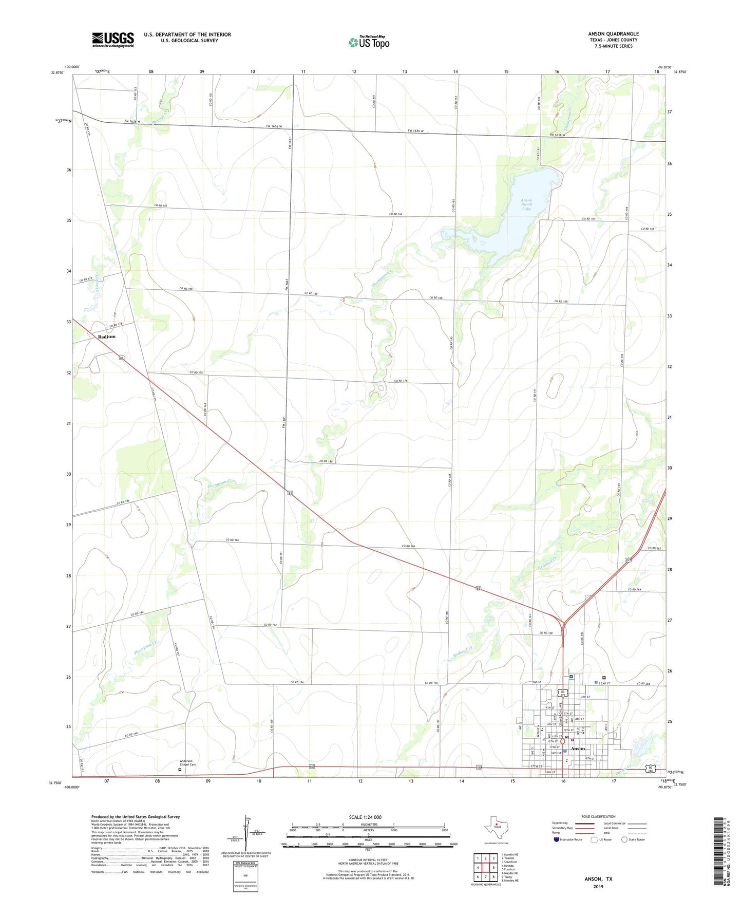
2022 topographic map quadrangle Anson in the state of Texas. Scale: 1:24000. Based on the newly updated USGS 7.5' US Topo map series, this map is in the following counties: Jones. The map contains contour data, water features, and other items you are used to seeing on USGS maps, but also has updated roads and other features. This is the next generation of topographic maps. Printed on high-quality waterproof paper with UV fade-resistant inks.
Quads adjacent to this one:
West: Neinda
Northwest: Hamlin NE
North: Tuxedo
Northeast: Stamford
East: Funston
Southeast: Hawley NE
South: Truby
Southwest: Noodle NE
This map covers the same area as the classic USGS quad with code o32099g8.
Contains the following named places: Anderson Chapel Cemetery, Anson, Anson City Hall, Anson Division, Anson Elementary School, Anson Fire Department, Anson General Hospital, Anson High School, Anson Middle School, Anson North Lake, Anson North Lake Dam, Anson Police Department, Anson Post Office, Bethsadia Baptist Church, City of Anson, Hanna Church, Jones County Constable's Office, Jones County Jail, Jones County Sheriff's Office, Plainview, Radium, Steen Airport, Tiger Stadium, West Central Texas Auto Theft Task Force