MyTopo
Truby Texas US Topo Map
Couldn't load pickup availability
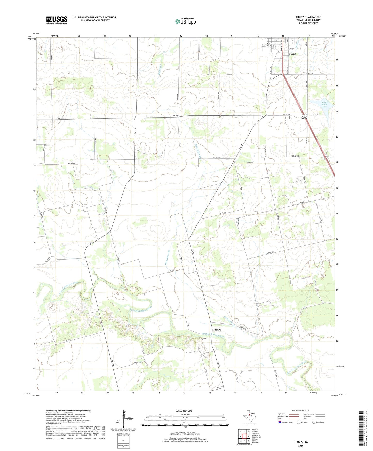
2022 topographic map quadrangle Truby in the state of Texas. Scale: 1:24000. Based on the newly updated USGS 7.5' US Topo map series, this map is in the following counties: Jones. The map contains contour data, water features, and other items you are used to seeing on USGS maps, but also has updated roads and other features. This is the next generation of topographic maps. Printed on high-quality waterproof paper with UV fade-resistant inks.
Quads adjacent to this one:
West: Noodle NE
Northwest: Neinda
North: Anson
Northeast: Funston
East: Hawley NE
Southeast: Hawley
South: Stith
Southwest: Noodle
This map covers the same area as the classic USGS quad with code o32099f8.
Contains the following named places: Amy Sears Oil Field, Anson South Lake, Bullard Oil Field, Church of Christ, City Lake, City Lake Dam, Dark Hollow Branch, East Bartlett Oil Field, Iglesia DeCristo, Jones County, Prairie View Cemetery, Prairie View Church, Truby, Truby Cemetery, Truby Oil Field, ZIP Code: 79501