MyTopo
Arbala Texas US Topo Map
Couldn't load pickup availability
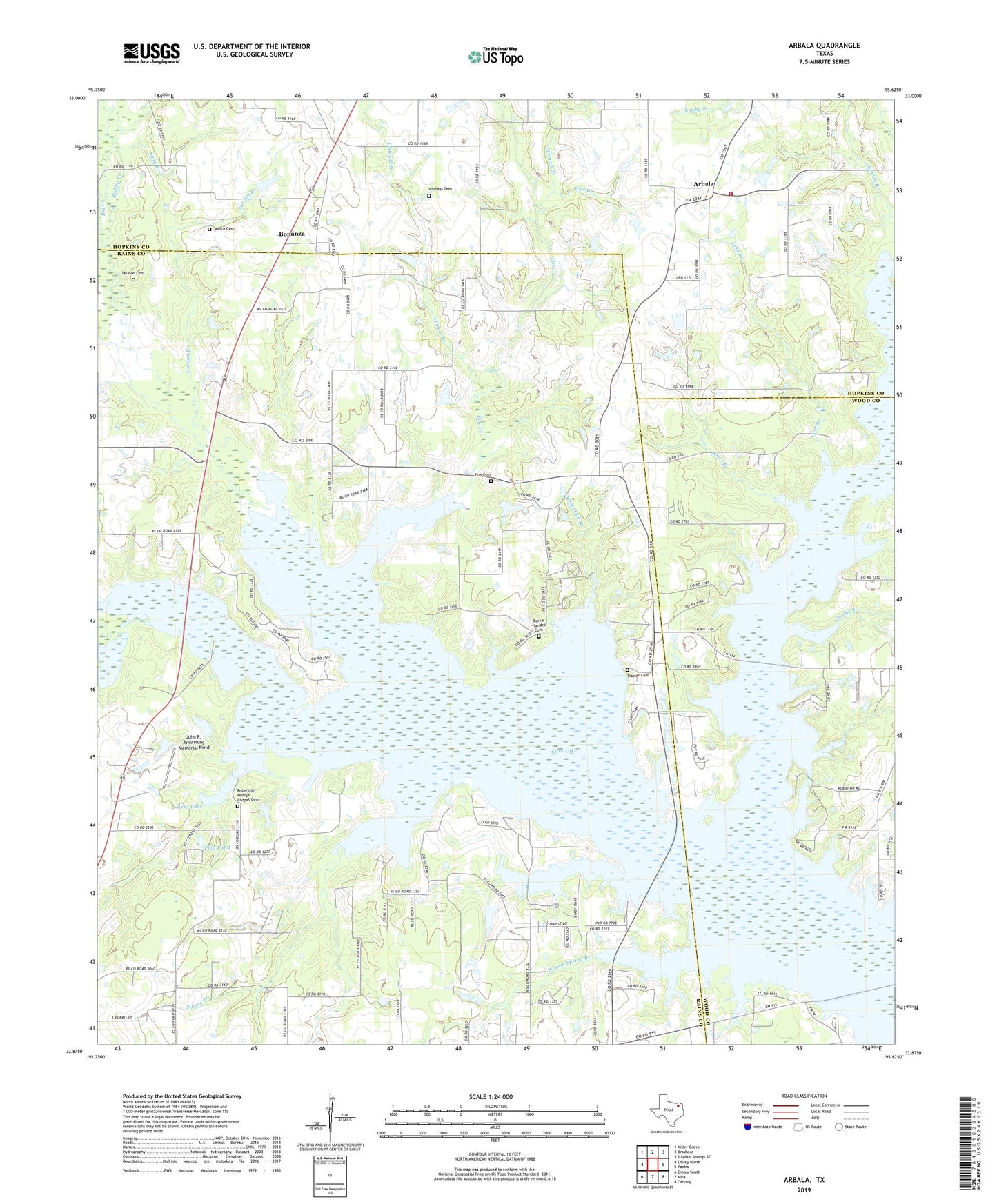
2019 topographic map quadrangle Arbala in the state of Texas. Scale: 1:24000. Based on the newly updated USGS 7.5' US Topo map series, this map is in the following counties: Rains, Hopkins, Wood. The map contains contour data, water features, and other items you are used to seeing on USGS maps, but also has updated roads and other features. This is the next generation of topographic maps. Printed on high-quality waterproof paper with UV fade-resistant inks.
Quads adjacent to this one:
West: Emory North
Northwest: Miller Grove
North: Brashear
Northeast: Sulphur Springs SE
East: Yantis
Southeast: Calvary
South: Alba
Southwest: Emory South
Contains the following named places: Arbala, Arbala Volunteer Fire and Rescue Department, Bernard Branch, Big Creek, Birch Creek, Boardtree Branch, Bonanza, Brier Branch, Burke - Yandell Cemetery, Case Lake Dam, Clicks Lake, Clicks Lake Dam, Deaton Cemetery, Double Branch, Elm Cemetery, Elm Creek, Flag Pond, Freedom Church, Garrett Creek, Gordon Branch, Hauak Lake, Hogansville, Ishmeal Branch, Ishmeal Cemetery, John R. Armstrong Memorial Field, Johnson Camp Branch, Kintchloe Branch, Linn Branch, Macedonia Church, Magee Branch, Penson Spring Branch, Pilgrim Rest Church, Poole, Reddig Creek, Robertson-Henrys Chapel Cemetery, Rock Branch, Sand Branch, Shady Grove, Shotgun Crossing, Slatter Cemetery, Sticky Branch, Welch Cemetery, White Oak Branch, ZIP Code: 75440