MyTopo
Avondale Texas US Topo Map
Couldn't load pickup availability
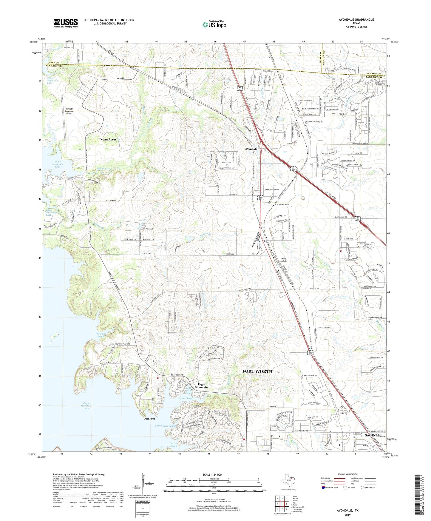
2022 topographic map quadrangle Avondale in the state of Texas. Scale: 1:24000. Based on the newly updated USGS 7.5' US Topo map series, this map is in the following counties: Tarrant, Wise, Denton. The map contains contour data, water features, and other items you are used to seeing on USGS maps, but also has updated roads and other features. This is the next generation of topographic maps. Printed on high-quality waterproof paper with UV fade-resistant inks.
Quads adjacent to this one:
West: Azle
Northwest: Boyd
North: Rhome
Northeast: Justin
East: Keller
Southeast: Haltom City
South: Lake Worth
Southwest: Springtown SE
This map covers the same area as the classic USGS quad with code o32097h4.
Contains the following named places: Avondale, Boswell High School, Bryson Elementary School, Carter Slough, City of Newark, Craft Point, Derrett Creek, Dido Church, Dido Methodist Church, Dosier Creek, Dosier Slough, Eagle Mountain, Eagle Mountain Census Designated Place, Eagle Mountain Elementary School, Eagle Mountain Lake, Eagle Mountain School, Eagle Mountain Volunteer Fire Department and Emergency Medical Services, Flemming Slough, Fort Worth Fire Department Station 40, Fort Worth Fire Department Station 41, Gilmore Branch, Hicks Airfield, Indian Creek, Kenneth Copeland Airport, Lakeview, Lakeview Baptist Church, Lakeview Church, Little Carter Slough, Little Dosier Creek, Little Dosier Slough, McCann Branch, Moss Branch, Pecan Acres, Pecan Acres Census Designated Place, Pioneer Stadium, William Houston Park, ZIP Code: 76179