MyTopo
Boyd Texas US Topo Map
Couldn't load pickup availability
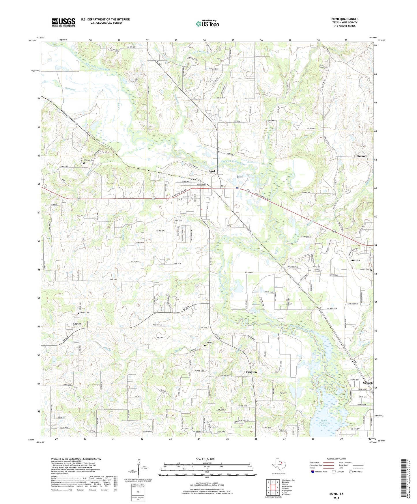
2022 topographic map quadrangle Boyd in the state of Texas. Scale: 1:24000. Based on the newly updated USGS 7.5' US Topo map series, this map is in the following counties: Wise. The map contains contour data, water features, and other items you are used to seeing on USGS maps, but also has updated roads and other features. This is the next generation of topographic maps. Printed on high-quality waterproof paper with UV fade-resistant inks.
Quads adjacent to this one:
West: Cottondale
Northwest: Bridgeport East
North: Decatur
Northeast: Bluett
East: Rhome
Southeast: Avondale
South: Azle
Southwest: Springtown
This map covers the same area as the classic USGS quad with code o33097a5.
Contains the following named places: Annaville, Annaville Church, Arkansas Cemetery, Aurora, Aurora City Hall, Blue Creek, Boyd, Boyd Cemetery, Boyd City Hall, Boyd Fire Department, Boyd High School, Boyd Intermediate School, Boyd Middle School, Boyd Police Department, Boyd Post Office, Boyd-Rhome Division, City of Aurora, Cottondale East Gas Field, Deep Creek, Deep Creek Cemetery, Dry Fork, Fairview, First Baptist Church, Garrett Creek, Grove Baptist Church, Hog Branch, Keeter, Keeter Cemetery, Little Walnut Creek, Lola Creek, Oates Branch, Pleasant Grove Church Number 2, Pope Cemetery, Salt Creek, Stokes Cemetery, Town of Boyd, Trinity Baptist Church, Walker Creek, Walnut Creek, Wise County Constable's Office Precinct 3, Yellowjacket Stadium, ZIP Code: 76023