MyTopo
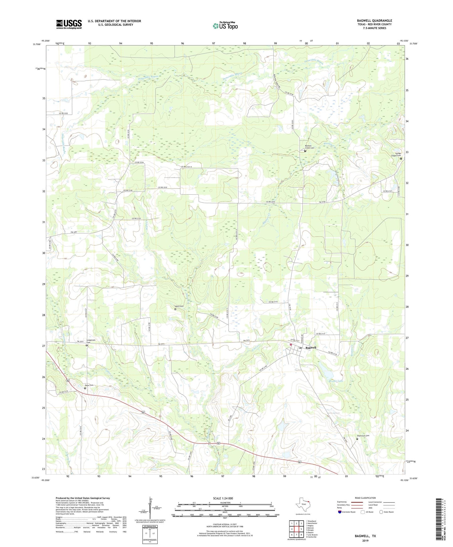
Bagwell Texas US Topo Map
Couldn't load pickup availability
2019 topographic map quadrangle Bagwell in the state of Texas. Scale: 1:24000. Based on the newly updated USGS 7.5' US Topo map series, this map is in the following counties: Red River. The map contains contour data, water features, and other items you are used to seeing on USGS maps, but also has updated roads and other features. This is the next generation of topographic maps. Printed on high-quality waterproof paper with UV fade-resistant inks.
Quads adjacent to this one:
West: Detroit
Northwest: Woodland
North: Manchester
Northeast: Negley
East: Dimple
Southeast: Clarksville
South: Line Branch
Southwest: Deport
Contains the following named places: Bagwell, Bagwell Community Volunteer Fire Department, Bagwell Post Office, Blanton Creek Cemetery, Bluff, Brooks Lake, Brooks Lake Dam, Coal Creek, Dean Cemetery, Detroit Division, Freeman Creek, Liberty Church, Longstreet Cemetery, Midway, Shamrock Cemetery, Ward Cemetery, Ward Creek, Youngs Chapel Cemetery, ZIP Code: 75436