MyTopo
Dimple Texas US Topo Map
Couldn't load pickup availability
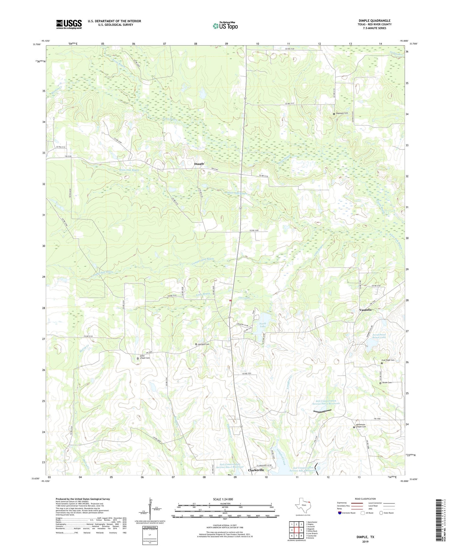
2022 topographic map quadrangle Dimple in the state of Texas. Scale: 1:24000. Based on the newly updated USGS 7.5' US Topo map series, this map is in the following counties: Red River. The map contains contour data, water features, and other items you are used to seeing on USGS maps, but also has updated roads and other features. This is the next generation of topographic maps. Printed on high-quality waterproof paper with UV fade-resistant inks.
Quads adjacent to this one:
West: Bagwell
Northwest: Manchester
North: Negley
Northeast: Acworth
East: White Rock
Southeast: Annona
South: Clarksville
Southwest: Line Branch
This map covers the same area as the classic USGS quad with code o33095f1.
Contains the following named places: Arrowhead Ranch Lake, Arrowhead Ranch Lake Dam, Blanton Creek, Campground Bayou, Carroll Creek, Cherry, Dam Number 2, Dam Number 3, Dam Number 4, Dimple, Free Hope Cemetery, Free Hope Church, Hopewell, Hopewell Cemetery, Hopewell Church, Little Bayou, Mount Zion Church, Negley Lookout Tower, New Haven Church, North Lake, North Lake Dam, Pine Grove Church, Shiloh Cemetery, Slate Rock Church, Soil Conservation Service Site 1 Reservoir, Soil Conservation Service Site 2 Dam, Soil Conservation Service Site 2 Reservoir, Soil Conservation Service Site 3 Dam, Soil Conservation Service Site 3 Reservoir, Soil Conservation Service Site 4 Dam, Soil Conservation Service Site 4 Reservoir, Stone Chapel Cemetery, Texas Forest Service Clarksville Office, Vandalia, Whitemans Chapel Cemetery, Williams Cemetery