MyTopo
Negley Texas US Topo Map
Couldn't load pickup availability
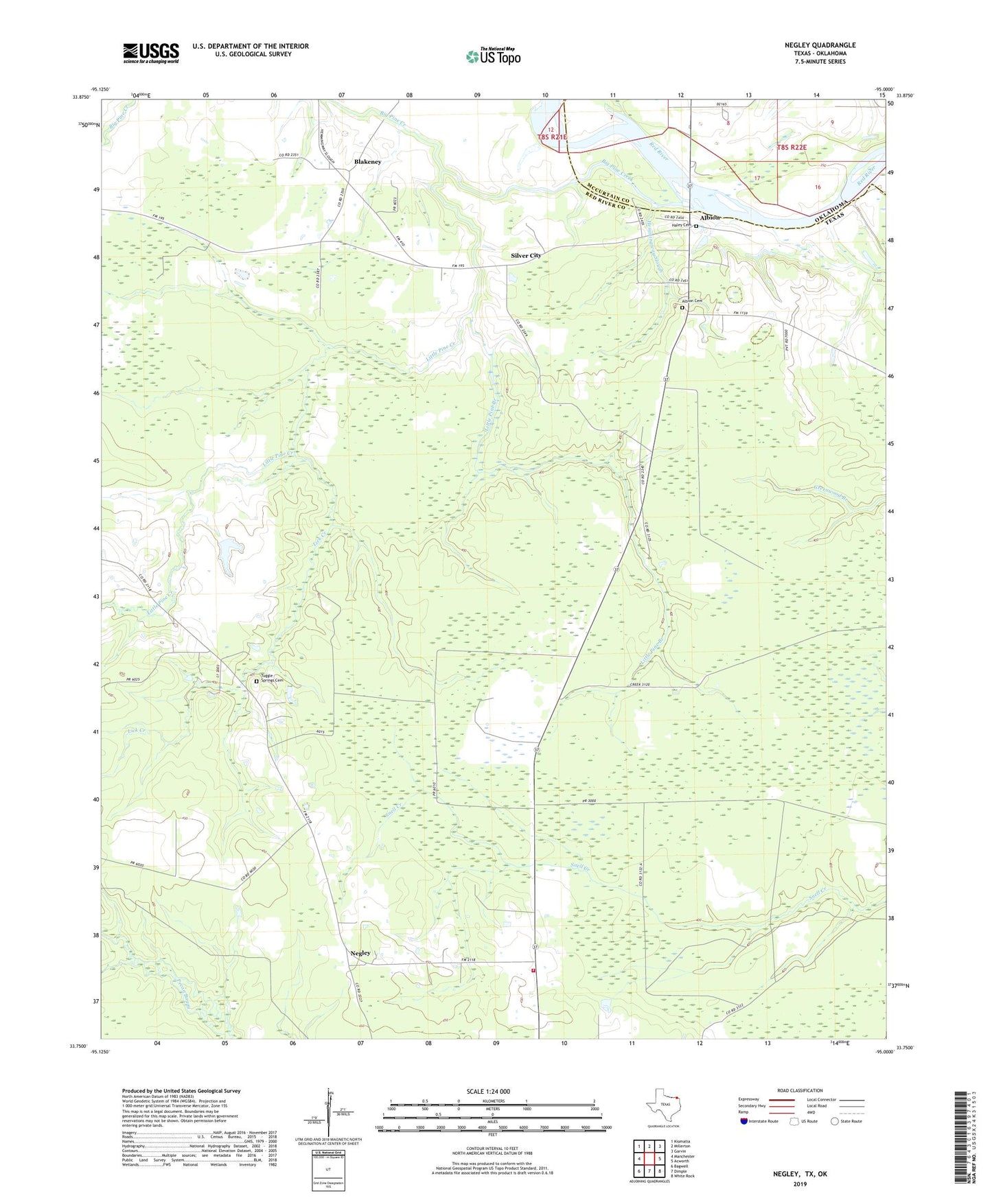
2022 topographic map quadrangle Negley in the state of Texas. Scale: 1:24000. Based on the newly updated USGS 7.5' US Topo map series, this map is in the following counties: Red River, McCurtain. The map contains contour data, water features, and other items you are used to seeing on USGS maps, but also has updated roads and other features. This is the next generation of topographic maps. Printed on high-quality waterproof paper with UV fade-resistant inks.
Quads adjacent to this one:
West: Manchester
Northwest: Kiomatia
North: Millerton
Northeast: Garvin
East: Acworth
Southeast: White Rock
South: Dimple
Southwest: Bagwell
This map covers the same area as the classic USGS quad with code o33095g1.
Contains the following named places: Albion, Albion Cemetery, Albion School, Big Pine Creek, Blakeney, Denwiddie Bayou, Haley Cemetery, Hemmingway Slough, Igo Dam Number 2, Igo Lake Number 2, Lick Creek, Little Pine Branch, Little Pine Creek, Negley, Negley Post Office, North Woods Volunteer Fire Department, Silver City, Tuggle Springs Cemetery