MyTopo
Baker Texas US Topo Map
Couldn't load pickup availability
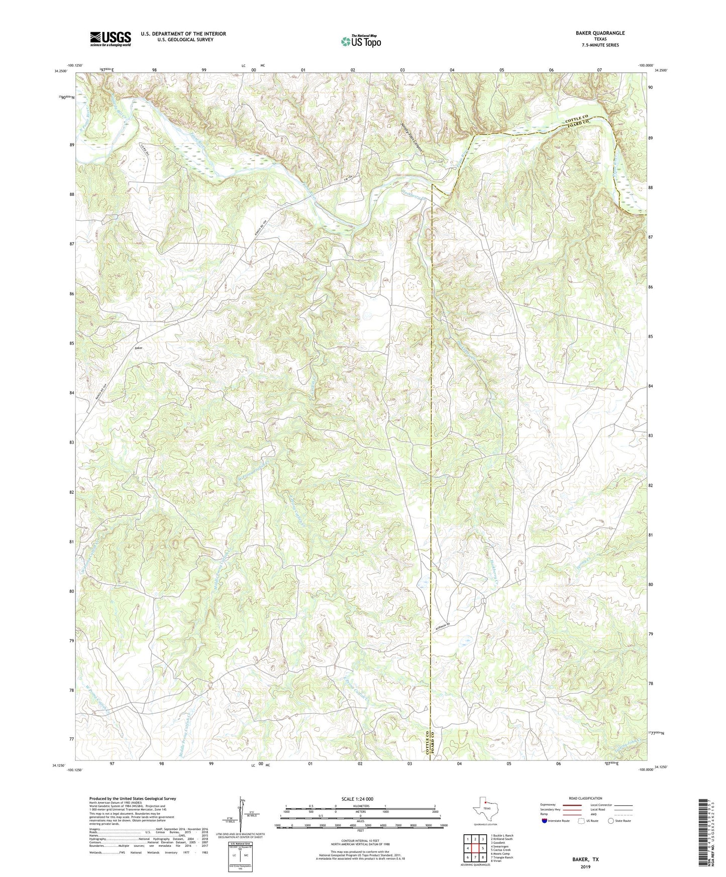
2022 topographic map quadrangle Baker in the state of Texas. Scale: 1:24000. Based on the newly updated USGS 7.5' US Topo map series, this map is in the following counties: Cottle, Foard. The map contains contour data, water features, and other items you are used to seeing on USGS maps, but also has updated roads and other features. This is the next generation of topographic maps. Printed on high-quality waterproof paper with UV fade-resistant inks.
Quads adjacent to this one:
West: Swearingen
Northwest: Buckle L Ranch
North: Kirkland South
Northeast: Goodlett
East: Cactus Creek
Southeast: Vivian
South: Triangle Ranch
Southwest: Moons Camp
This map covers the same area as the classic USGS quad with code o34100b1.
Contains the following named places: Baker, Catfish Creek, East Prong Catfish Creek, Hackberry Creek, Middle Pease River, Middle Prong Catfish Creek, Ninety-Foot Canyon, North Pease River, Pen Windmill, Raggedy Bill Creek, West Prong Catfish Creek, Y L Ranch