MyTopo
Cactus Creek Texas US Topo Map
Couldn't load pickup availability
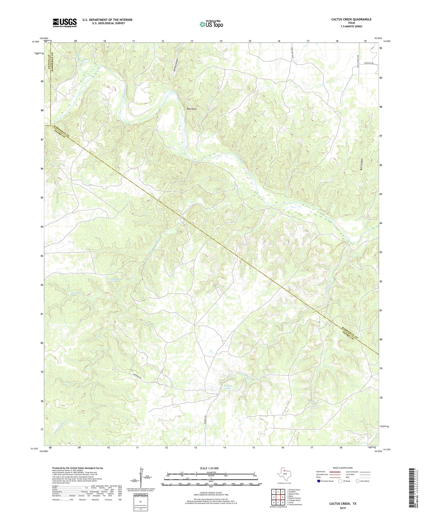
2022 topographic map quadrangle Cactus Creek in the state of Texas. Scale: 1:24000. Based on the newly updated USGS 7.5' US Topo map series, this map is in the following counties: Foard, Hardeman, Cottle. The map contains contour data, water features, and other items you are used to seeing on USGS maps, but also has updated roads and other features. This is the next generation of topographic maps. Printed on high-quality waterproof paper with UV fade-resistant inks.
Quads adjacent to this one:
West: Baker
Northwest: Kirkland South
North: Goodlett
Northeast: Quanah West
East: Maybell Canyon
Southeast: Teacup Mountain
South: Vivian
Southwest: Triangle Ranch
This map covers the same area as the classic USGS quad with code o34099b8.
Contains the following named places: Bull Canyon, Cactus Creek, Canyon Tank, Clear Creek, Dripping Springs, Red Bluff, Spring Canyon, Spring Creek, Talking John Creek, Talking John Springs, Willow Tank