MyTopo
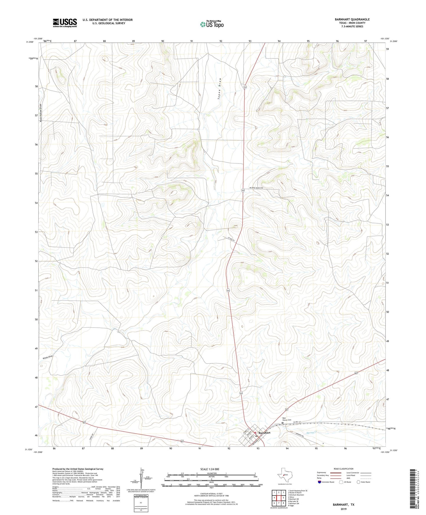
Barnhart Texas US Topo Map
Couldn't load pickup availability
2022 topographic map quadrangle Barnhart in the state of Texas. Scale: 1:24000. Based on the newly updated USGS 7.5' US Topo map series, this map is in the following counties: Irion. The map contains contour data, water features, and other items you are used to seeing on USGS maps, but also has updated roads and other features. This is the next generation of topographic maps. Printed on high-quality waterproof paper with UV fade-resistant inks.
Quads adjacent to this one:
West: Witco
Northwest: South Mustang Draw SE
North: Rocker B Ranch
Northeast: Ketchum Mountain
East: Barnhart NE
Southeast: Suggs
South: Barnhart SW
Southwest: Big Lake SE
This map covers the same area as the classic USGS quad with code o31101b2.
Contains the following named places: Barnhart, Barnhart Post Office, Barnhart Volunteer Fire Department, Graphite Windmill, Park Trap Windmill, Park Windmill, Rest Haven Cemetery, West Bluff Windmill, Woods Draw