MyTopo
Berea Texas US Topo Map
Couldn't load pickup availability
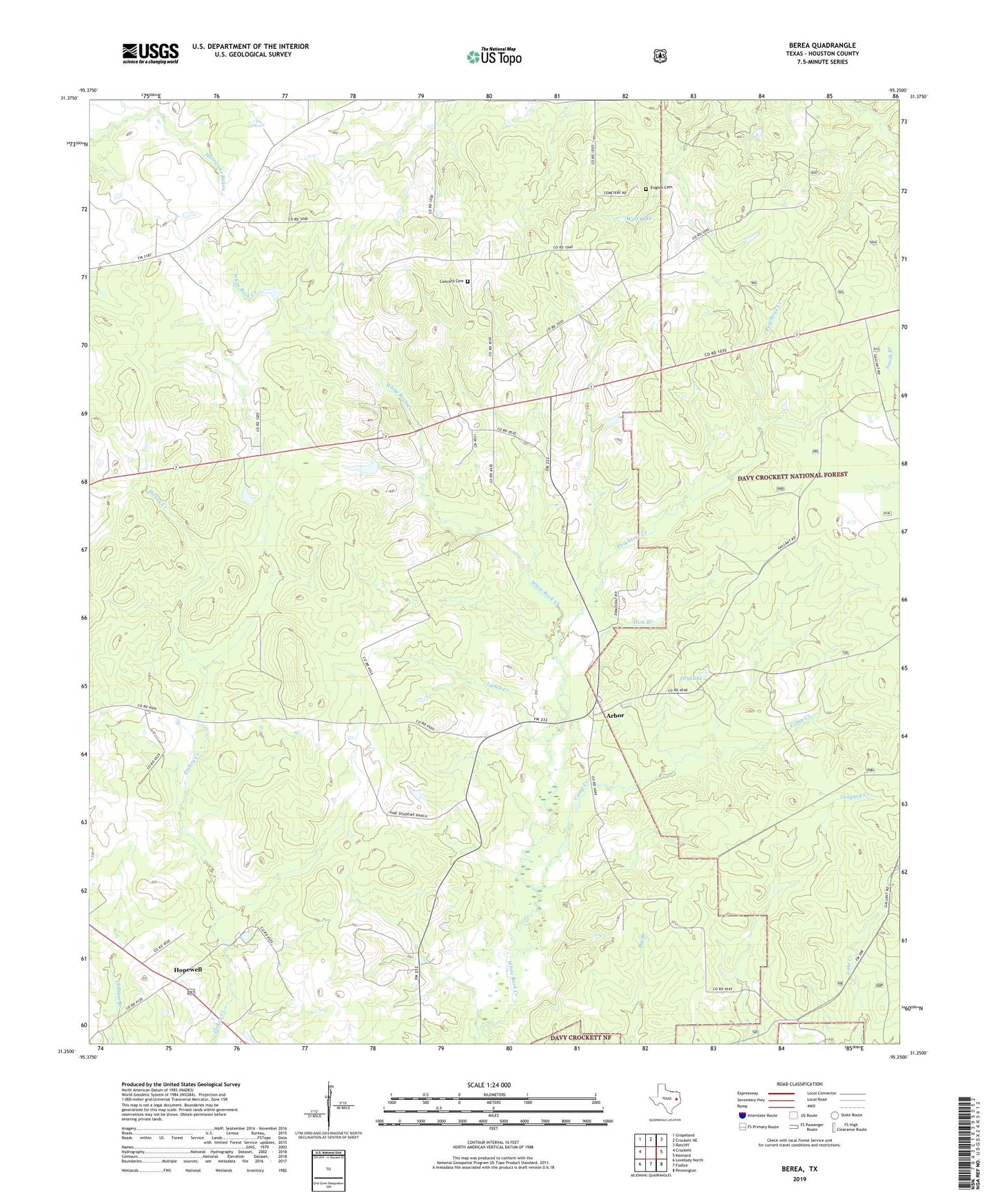
2019 topographic map quadrangle Berea in the state of Texas. Scale: 1:24000. Based on the newly updated USGS 7.5' US Topo map series, this map is in the following counties: Houston. The map contains contour data, water features, and other items you are used to seeing on USGS maps, but also has updated roads and other features. This is the next generation of topographic maps. Printed on high-quality waterproof paper with UV fade-resistant inks.
Quads adjacent to this one:
West: Crockett
Northwest: Grapeland
North: Crockett NE
Northeast: Ratcliff
East: Kennard
Southeast: Pennington
South: Fodice
Southwest: Lovelady North
Contains the following named places: Arbor, Arbor School, Berea, Berea Church, Bethel Church, Camp Creek, Concord Cemetery, Concord Church, Daniel-Belview School, Douglas School, DryLake, English Cemetery, Hall Church, Hick Branch, Hopewell, Julian Post Office, Lynch Creek, Peachtree Creek, Pleasant Grove Church, Wolf Lake, Woodman Hall