MyTopo
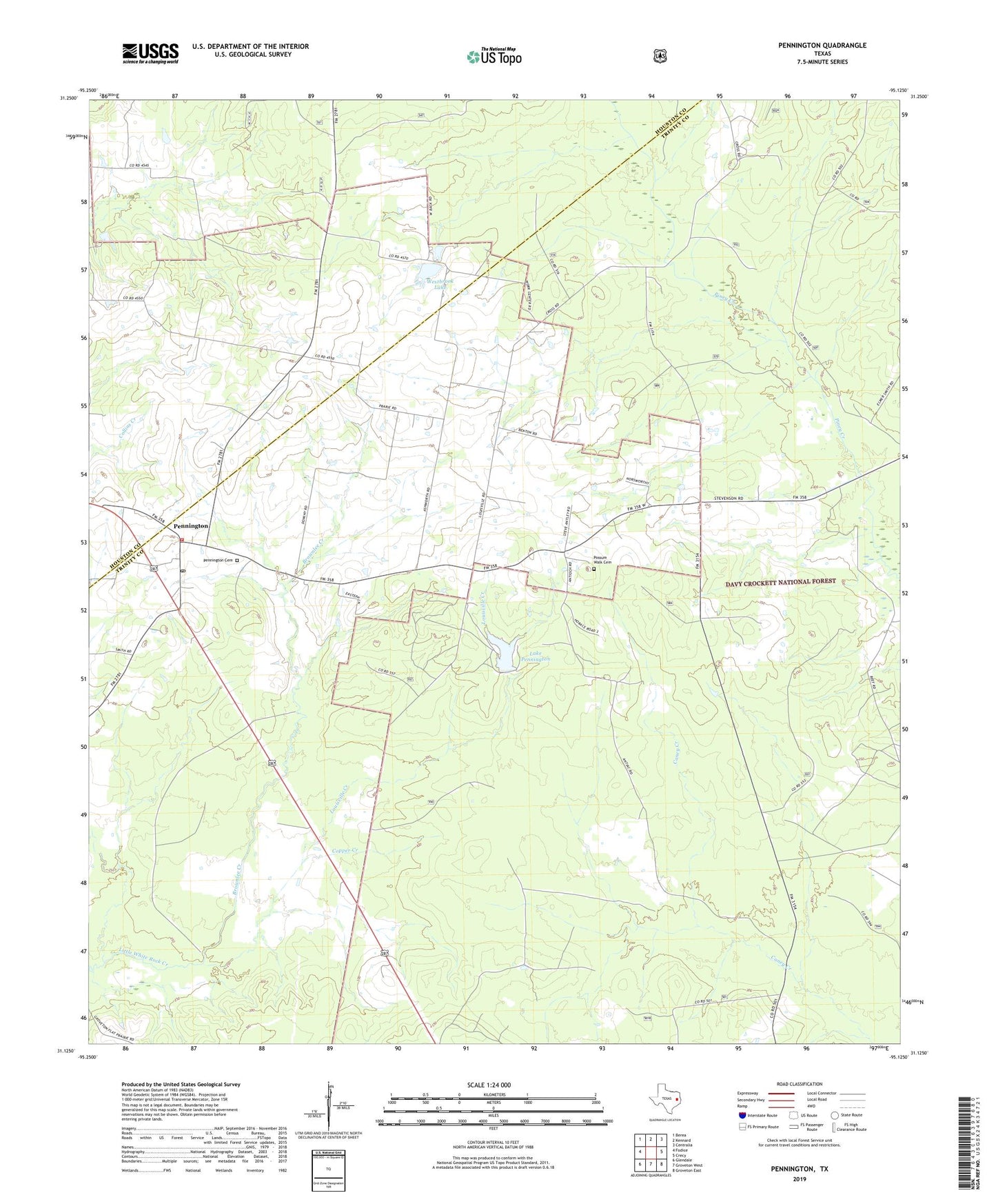
Pennington Texas US Topo Map
Couldn't load pickup availability
Also explore the Pennington Forest Service Topo of this same quad for updated USFS data
2022 topographic map quadrangle Pennington in the state of Texas. Scale: 1:24000. Based on the newly updated USGS 7.5' US Topo map series, this map is in the following counties: Trinity, Houston. The map contains contour data, water features, and other items you are used to seeing on USGS maps, but also has updated roads and other features. This is the next generation of topographic maps. Printed on high-quality waterproof paper with UV fade-resistant inks.
Quads adjacent to this one:
West: Fodice
Northwest: Berea
North: Kennard
Northeast: Centralia
East: Crecy
Southeast: Groveton East
South: Groveton West
Southwest: Glendale
This map covers the same area as the classic USGS quad with code o31095b2.
Contains the following named places: Antioch Church, Brownlee Creek, Copper Creek, Cross Roads Church, Durden Church, East Prairie Church, Friendship, Lake Pennington, Lake Pennington Dam, Louisville Creek, Pennington, Pennington Cemetery, Pennington Fire Department, Pennington Post Office, Possum Walk Cemetery, Westbrook Lake, Westbrook Lake Dam