MyTopo
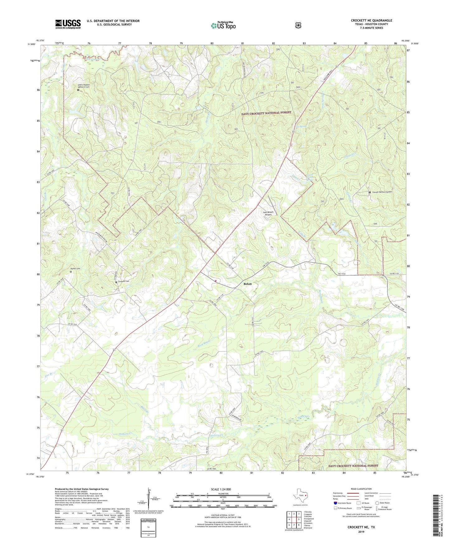
Crockett NE Texas US Topo Map
Couldn't load pickup availability
Also explore the Crockett NE Forest Service Topo of this same quad for updated USFS data
2022 topographic map quadrangle Crockett NE in the state of Texas. Scale: 1:24000. Based on the newly updated USGS 7.5' US Topo map series, this map is in the following counties: Houston. The map contains contour data, water features, and other items you are used to seeing on USGS maps, but also has updated roads and other features. This is the next generation of topographic maps. Printed on high-quality waterproof paper with UV fade-resistant inks.
Quads adjacent to this one:
West: Grapeland
Northwest: Percilla
North: Augusta
Northeast: Weches
East: Ratcliff
Southeast: Kennard
South: Berea
Southwest: Crockett
This map covers the same area as the classic USGS quad with code o31095d3.
Contains the following named places: Belott, Belott Masonic Lodge, Belott Post Office, Belott School, Belott Volunteer Fire Department, Belott Woodmen of the World Lodge, Black Branch, Broxson Lake, Broxson Lake Dam, Caney Creek, Cook Branch, Dibrell Airport, Edens-Madden Massacre Cemetery, Edens-Madden Massacre Site, Fennell Memory Garden, Fennell/Robertson Genealogy Society Library, Ferrell Branch Spring, Germany, Gilbreath Memorial Library, Glover School, Grounds Cemetery, Hayman Creek, Hickory Creek, Kelly Branch, Last Resort Airport, Lockey Gin, New Energy Church, Old Enterprise School, Parker Cemetery, Pine Spring, Pine Springs Campground, Pleasant Hill Church, Strode-Pritchet Cabin, Viola School