MyTopo
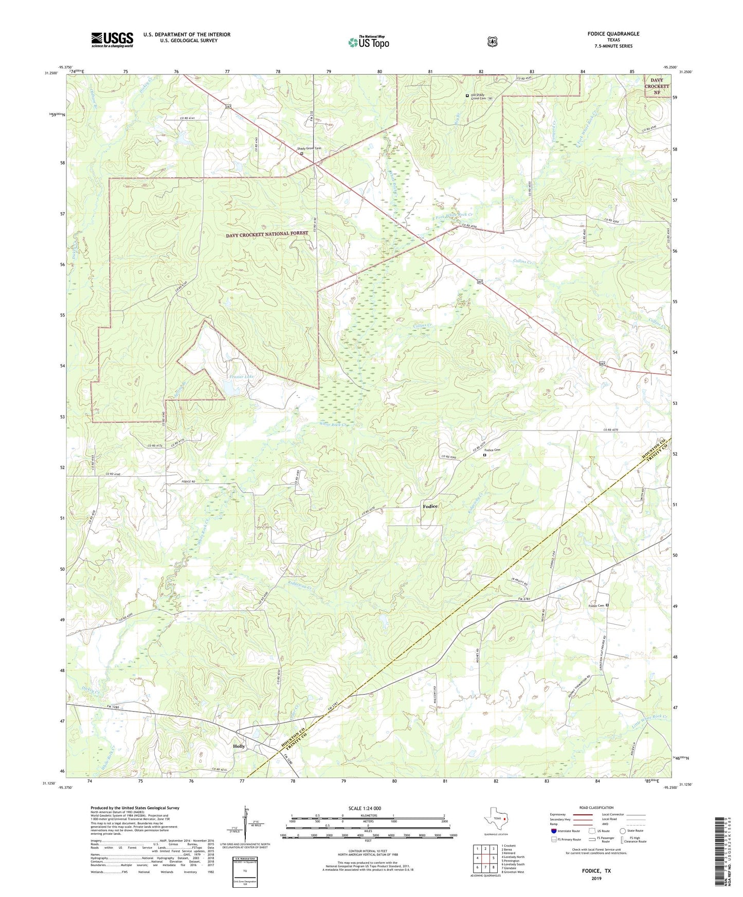
Fodice Texas US Topo Map
Couldn't load pickup availability
Also explore the Fodice Forest Service Topo of this same quad for updated USFS data
2022 topographic map quadrangle Fodice in the state of Texas. Scale: 1:24000. Based on the newly updated USGS 7.5' US Topo map series, this map is in the following counties: Houston, Trinity. The map contains contour data, water features, and other items you are used to seeing on USGS maps, but also has updated roads and other features. This is the next generation of topographic maps. Printed on high-quality waterproof paper with UV fade-resistant inks.
Quads adjacent to this one:
West: Lovelady North
Northwest: Crockett
North: Berea
Northeast: Kennard
East: Pennington
Southeast: Groveton West
South: Glendale
Southwest: Lovelady South
This map covers the same area as the classic USGS quad with code o31095b3.
Contains the following named places: Big Branch, Collins Creek, Dickey Creek, East Fork White Rock Creek, Flat Prairie Baptist Church, Fodice, Fodice Cemetery, Fodice Community Center, Fodice Marker, Foster Cemetery, Frazier Lake, Frazier Lake Dam, Holly, Lake Creek, Lake Creek Church, Mount Pleasant C.M.E. Methodist Church, Mount Senore Baptist Church, Old Shady Grove Baptist Church, Old Shady Grove Cemetery, Old Shady Grove School, Oldham Branch, Pine Grove Baptist Church, Plainview, Ridgeway Creek, Shady Grove, Shady Grove Baptist Church, Shady Grove Cemetery, Shady Grove Lookout Tower, Shady Grove School, Spring Branch, Tanyard Creek, Thankful Missionary Baptist Church, White Rock United Methodist Church, ZIP Code: 75856