MyTopo
Big Four Ranch Texas US Topo Map
Couldn't load pickup availability
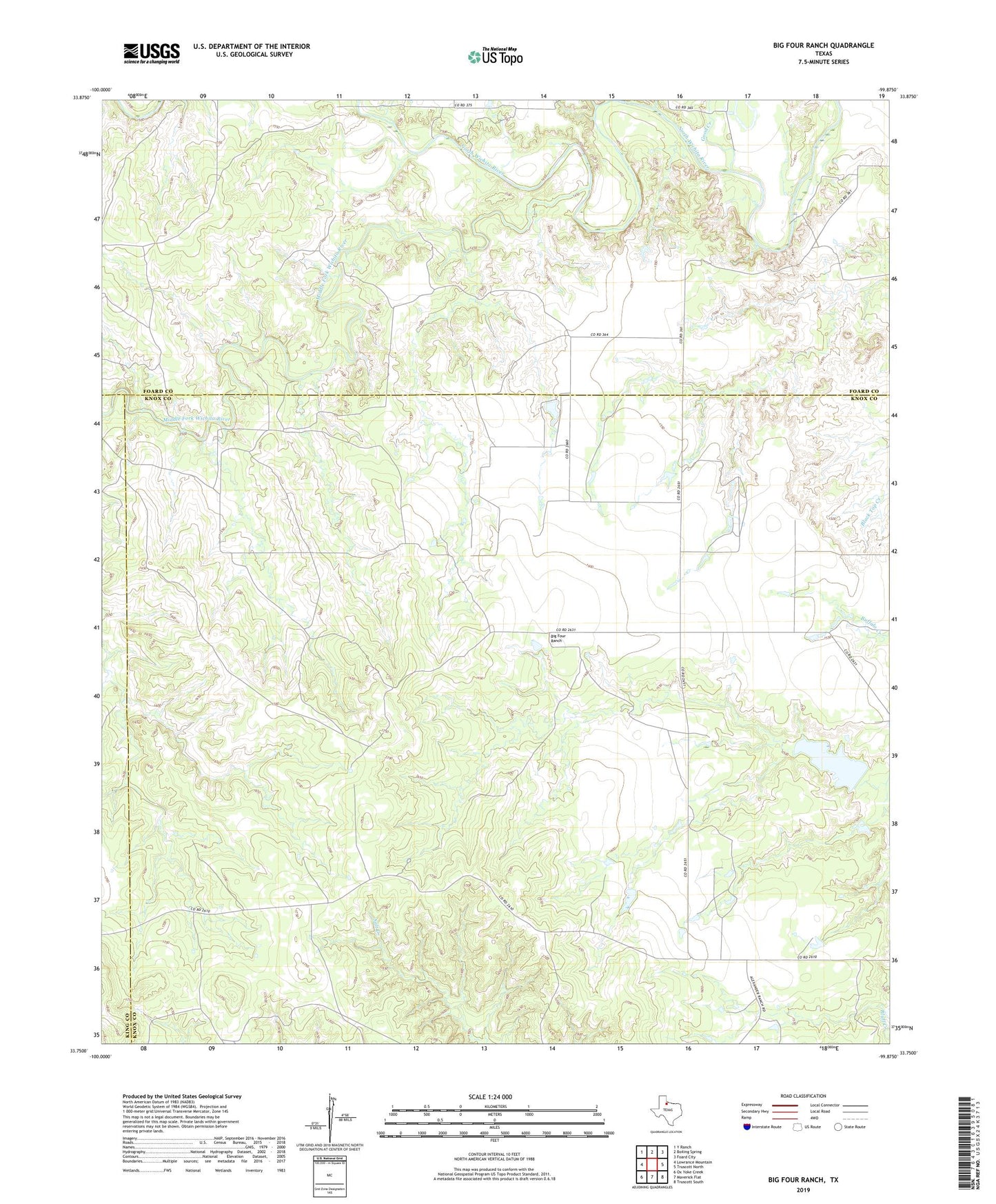
2022 topographic map quadrangle Big Four Ranch in the state of Texas. Scale: 1:24000. Based on the newly updated USGS 7.5' US Topo map series, this map is in the following counties: Knox, Foard, King. The map contains contour data, water features, and other items you are used to seeing on USGS maps, but also has updated roads and other features. This is the next generation of topographic maps. Printed on high-quality waterproof paper with UV fade-resistant inks.
Quads adjacent to this one:
West: Lowrance Mountain
Northwest: Y Ranch
North: Boiling Spring
Northeast: Foard City
East: Truscott North
Southeast: Truscott South
South: Maverick Flat
Southwest: Ox Yoke Creek
This map covers the same area as the classic USGS quad with code o33099g8.
Contains the following named places: Big Four Ranch, Good Creek, Harry T Traweek Lake Dam, Harry Traweek Lake, Middle Fork Wichita River