MyTopo
Lowrance Mountain Texas US Topo Map
Couldn't load pickup availability
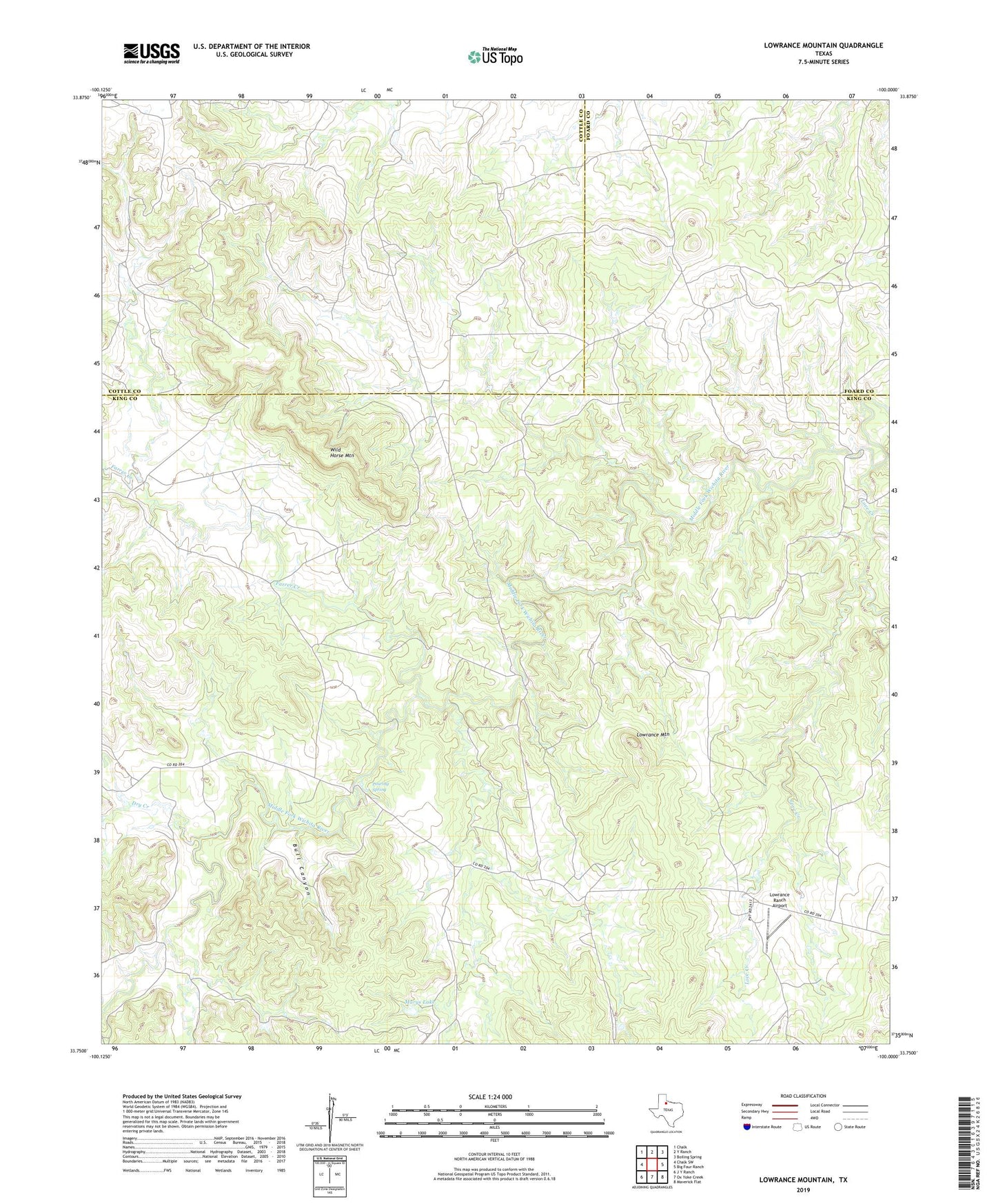
2022 topographic map quadrangle Lowrance Mountain in the state of Texas. Scale: 1:24000. Based on the newly updated USGS 7.5' US Topo map series, this map is in the following counties: King, Cottle, Foard. The map contains contour data, water features, and other items you are used to seeing on USGS maps, but also has updated roads and other features. This is the next generation of topographic maps. Printed on high-quality waterproof paper with UV fade-resistant inks.
Quads adjacent to this one:
West: Chalk SW
Northwest: Chalk
North: Y Ranch
Northeast: Boiling Spring
East: Big Four Ranch
Southeast: Maverick Flat
South: Ox Yoke Creek
Southwest: J Y Ranch
This map covers the same area as the classic USGS quad with code o33100g1.
Contains the following named places: Bull Canyon, Dry Creek, Farrer Creek, Juniper Gas Field, Love Creek, Lowrance Mountain, Lowrance Ranch, Lowrance Ranch Airport, Marys Lake, Pouring Spring, Wild Horse Mountain