MyTopo
Big Mound Texas US Topo Map
Couldn't load pickup availability
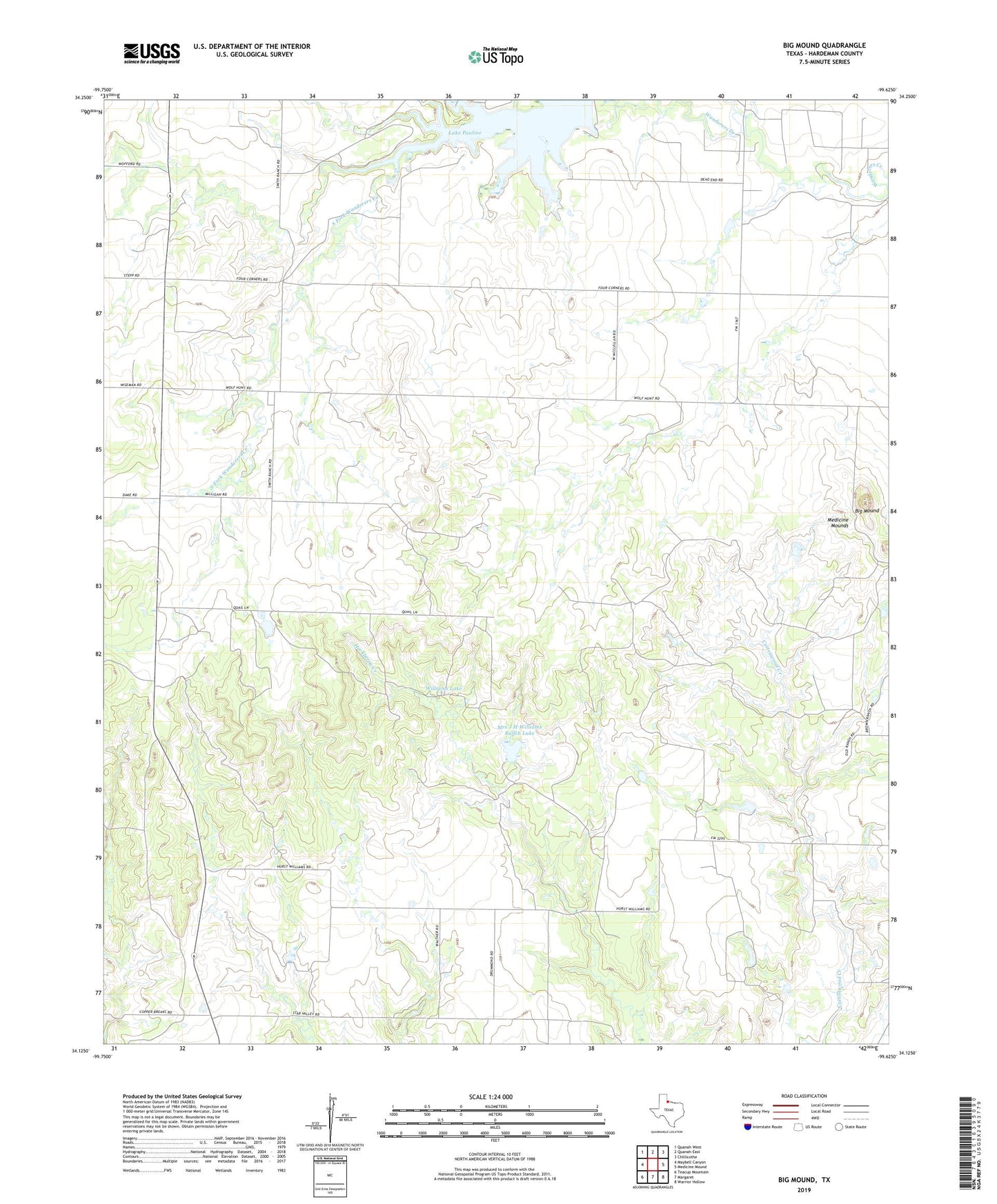
2019 topographic map quadrangle Big Mound in the state of Texas. Scale: 1:24000. Based on the newly updated USGS 7.5' US Topo map series, this map is in the following counties: Hardeman. The map contains contour data, water features, and other items you are used to seeing on USGS maps, but also has updated roads and other features. This is the next generation of topographic maps. Printed on high-quality waterproof paper with UV fade-resistant inks.
Quads adjacent to this one:
West: Maybell Canyon
Northwest: Quanah West
North: Quanah East
Northeast: Chillicothe
East: Medicine Mound
Southeast: Warrior Hollow
South: Margaret
Southwest: Teacup Mountain
Contains the following named places: Big Mound, Lake Pauline, Liberty Community Hall, Mrs J H Williams Ranch Lake, Mrs J H Williams Ranch Lake Dam, South Fork Wanderers Creek, Williams Lake, Williams Lake Dam