MyTopo
Teacup Mountain Texas US Topo Map
Couldn't load pickup availability
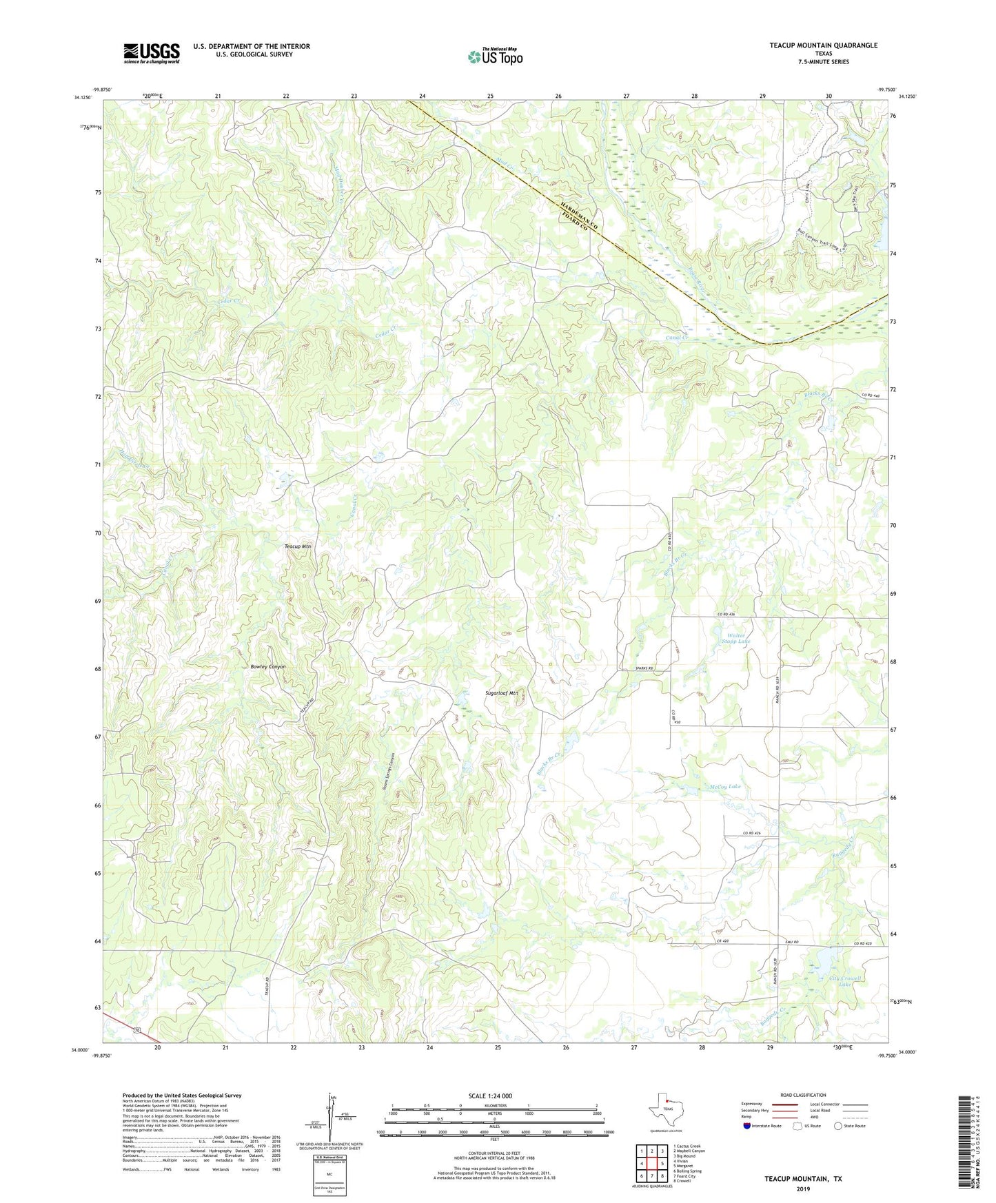
2022 topographic map quadrangle Teacup Mountain in the state of Texas. Scale: 1:24000. Based on the newly updated USGS 7.5' US Topo map series, this map is in the following counties: Foard, Hardeman. The map contains contour data, water features, and other items you are used to seeing on USGS maps, but also has updated roads and other features. This is the next generation of topographic maps. Printed on high-quality waterproof paper with UV fade-resistant inks.
Quads adjacent to this one:
West: Vivian
Northwest: Cactus Creek
North: Maybell Canyon
Northeast: Big Mound
East: Margaret
Southeast: Crowell
South: Foard City
Southwest: Boiling Spring
This map covers the same area as the classic USGS quad with code o34099a7.
Contains the following named places: Bowley Canyon, Canal Creek, Canal Creek Oil Field, Cedar Creek, City Crowell Lake, City Crowell Lake Dam, Copper Breaks State Park, Copper Breaks State Park Trail, Half Circle Creek, McCoy Lake, McCoy Lake Dam, Mud Creek, Mud Dauber Creek, Sloans Springs Canyon, Sugarloaf Mountain, Teacup Mountain, Walter Stapp Lake, Walter Stapp Lake Dam