MyTopo
Bitter Well Mountain NW Texas US Topo Map
Couldn't load pickup availability
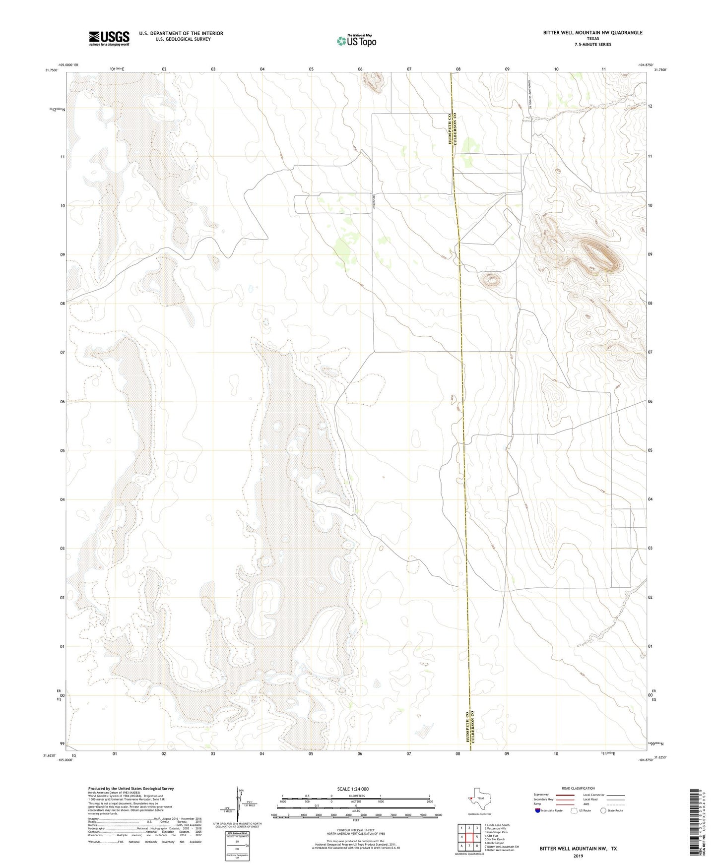
2022 topographic map quadrangle Bitter Well Mountain NW in the state of Texas. Scale: 1:24000. Based on the newly updated USGS 7.5' US Topo map series, this map is in the following counties: Hudspeth, Culberson. The map contains contour data, water features, and other items you are used to seeing on USGS maps, but also has updated roads and other features. This is the next generation of topographic maps. Printed on high-quality waterproof paper with UV fade-resistant inks.
Quads adjacent to this one:
West: Salt Flat
Northwest: Linda Lake South
North: Patterson Hills
Northeast: Guadalupe Pass
East: Six Bar Ranch
Southeast: Bitter Well Mountain
South: Bitter Well Mountain SW
Southwest: Babb Canyon
This map covers the same area as the classic USGS quad with code o31104f8.
Contains the following named places: Black John Well, Hardluck Well, Hogue Well, Sailt Lake, Soda Well