MyTopo
Black Hills Texas US Topo Map
Couldn't load pickup availability
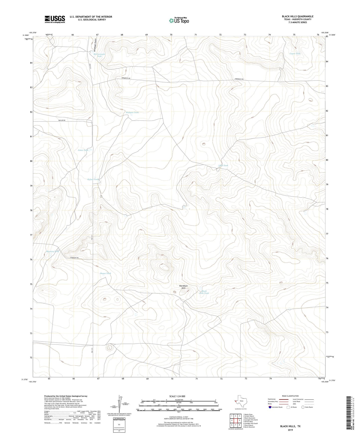
2022 topographic map quadrangle Black Hills in the state of Texas. Scale: 1:24000. Based on the newly updated USGS 7.5' US Topo map series, this map is in the following counties: Hudspeth. The map contains contour data, water features, and other items you are used to seeing on USGS maps, but also has updated roads and other features. This is the next generation of topographic maps. Printed on high-quality waterproof paper with UV fade-resistant inks.
Quads adjacent to this one:
West: Gunsight Hills North
Northwest: Baylor Draw
North: Scratch Ranch
Northeast: Black Mountains
East: Norton Mesa
Southeast: Movie Mountain
South: Pierce Ranch
Southwest: Gunsight Hills South
This map covers the same area as the classic USGS quad with code o31105d3.
Contains the following named places: Black Hills Tank, Bogus Tank, Count Tank, Dishpan Tank, Horseshoe Tank, Jones Tank, Kelsey Tank, Maupin Ranch, McGunnegle Tank, Moon Ranch, Mystery Tank, Red Black Hills, Red Tank