MyTopo
Black Mountains Texas US Topo Map
Couldn't load pickup availability
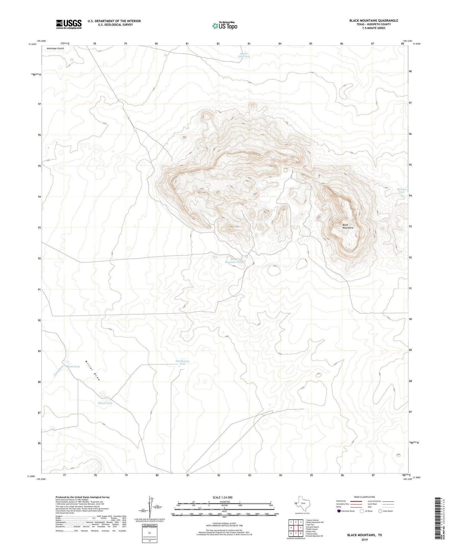
2022 topographic map quadrangle Black Mountains in the state of Texas. Scale: 1:24000. Based on the newly updated USGS 7.5' US Topo map series, this map is in the following counties: Hudspeth. The map contains contour data, water features, and other items you are used to seeing on USGS maps, but also has updated roads and other features. This is the next generation of topographic maps. Printed on high-quality waterproof paper with UV fade-resistant inks.
Quads adjacent to this one:
West: Scratch Ranch
Northwest: Hueco Station
North: Black Mountains NW
Northeast: Salt Flat
East: Babb Canyon
Southeast: Sneed Mountain NE
South: Norton Mesa
Southwest: Black Hills
This map covers the same area as the classic USGS quad with code o31105e2.
Contains the following named places: Black Mountain Tank, Black Mountains, Bond Tank, Clifton Tank, Count Draw, Flat Bottom Tank, Hartnet Tank, McAdoo Tank, Quatro Julio Tank