MyTopo
Blue Hole Springs Texas US Topo Map
Couldn't load pickup availability
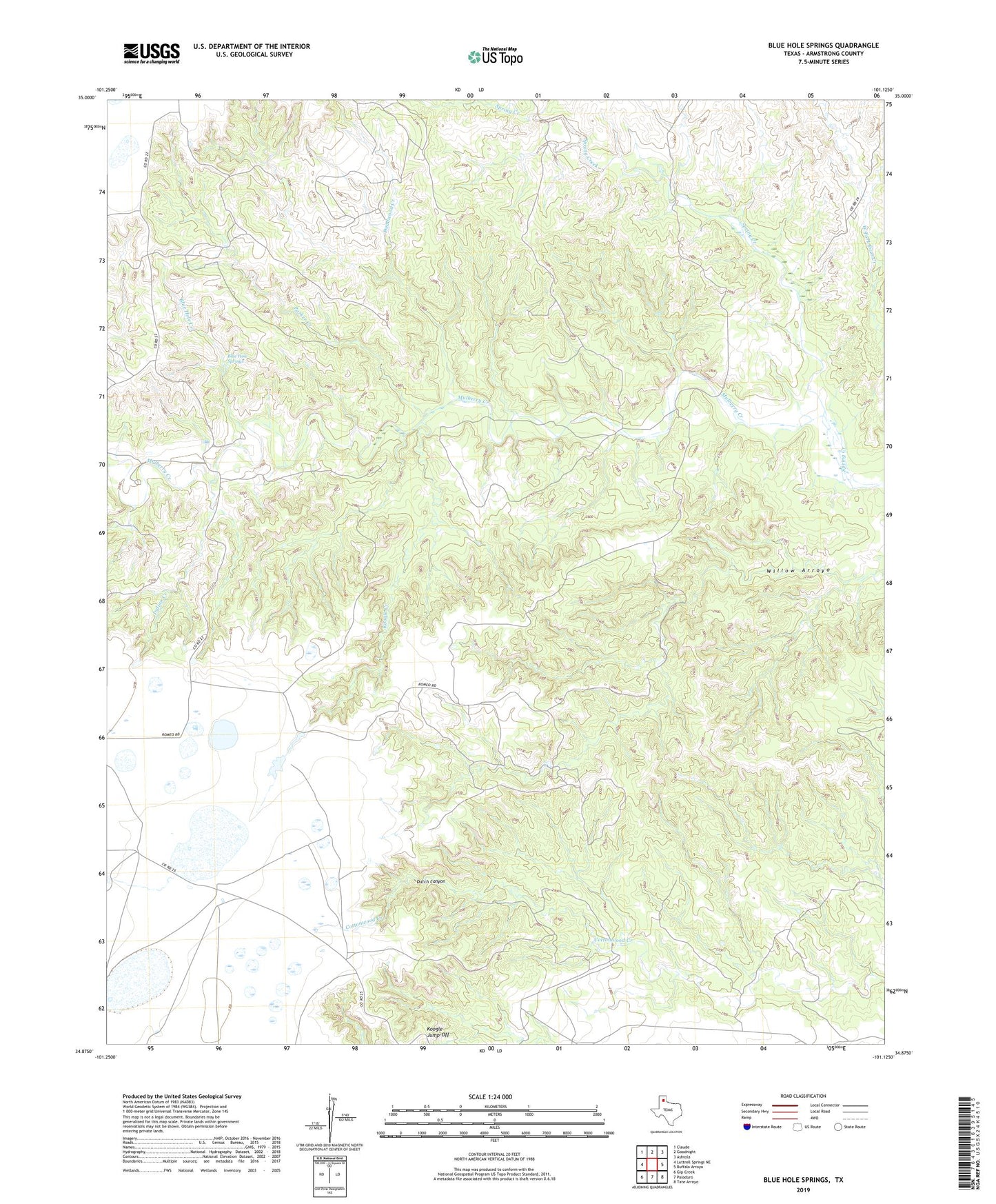
2022 topographic map quadrangle Blue Hole Springs in the state of Texas. Scale: 1:24000. Based on the newly updated USGS 7.5' US Topo map series, this map is in the following counties: Armstrong. The map contains contour data, water features, and other items you are used to seeing on USGS maps, but also has updated roads and other features. This is the next generation of topographic maps. Printed on high-quality waterproof paper with UV fade-resistant inks.
Quads adjacent to this one:
West: Luttrell Springs NE
Northwest: Claude
North: Goodnight
Northeast: Ashtola
East: Buffalo Arroyo
Southeast: Tate Arroyo
South: Paloduro
Southwest: Gip Creek
This map covers the same area as the classic USGS quad with code o34101h2.
Contains the following named places: Blue Hole Creek, Blue Hole Springs, Deadwood Creek, Dutch Canyon, Indian Creek, Koogle Creek, Koogle Jump-Off, Parker Creek, Plains Corral, Spring Creek