MyTopo
Bluff Dale Texas US Topo Map
Couldn't load pickup availability
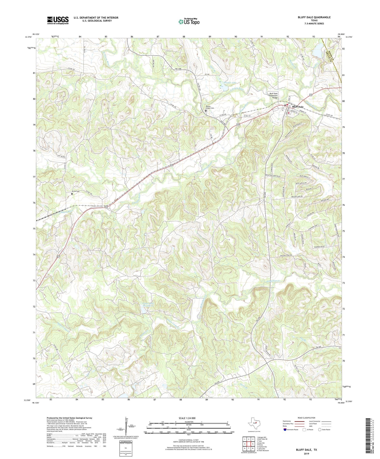
2019 topographic map quadrangle Bluff Dale in the state of Texas. Scale: 1:24000. Based on the newly updated USGS 7.5' US Topo map series, this map is in the following counties: Erath, Hood. The map contains contour data, water features, and other items you are used to seeing on USGS maps, but also has updated roads and other features. This is the next generation of topographic maps. Printed on high-quality waterproof paper with UV fade-resistant inks.
Quads adjacent to this one:
West: Knob Hill
Northwest: Morgan Mill
North: Bluff Dale NE
Northeast: Tolar
East: Paluxy
Southeast: Chalk Mountain
South: Johnsville
Southwest: Stephenville
Contains the following named places: Acrea Cemetery, Berrys Creek, Bluff Dale, Bluff Dale Census Designated Place, Bluff Dale Post Office, Bluff Dale Suspension Bridge, Bluff Dale Volunteer Fire Department, Cedar Point Church, Crockett Creek, Elmir Branch, Foster Lake Number 1, Foster Lake Number 1 Dam, Foster Lake Number 2, Foster Lake Number 2 Dam, Hamilton Public Library, Indian Camp Creek, KYOT-FM (Granbury), Mount Zion Church, North Paluxy River, Pilot Knob Church, Ratliff Airport, Soil Conservation Service Site 11 Dam, Soil Conservation Service Site 11 Reservoir, South Paluxy River, Spindor Lake, Spindor Lake Dam, Triangle Ranch, Wesley Chapel Cemetery, Wolf Creek, ZIP Code: 76433