MyTopo
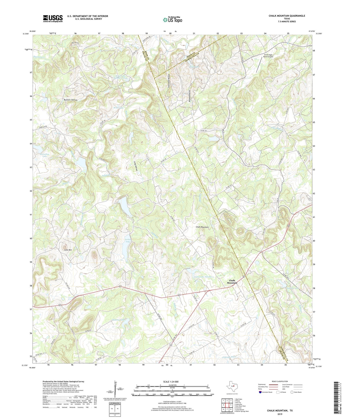
Chalk Mountain Texas US Topo Map
Couldn't load pickup availability
2022 topographic map quadrangle Chalk Mountain in the state of Texas. Scale: 1:24000. Based on the newly updated USGS 7.5' US Topo map series, this map is in the following counties: Erath, Somervell, Hood. The map contains contour data, water features, and other items you are used to seeing on USGS maps, but also has updated roads and other features. This is the next generation of topographic maps. Printed on high-quality waterproof paper with UV fade-resistant inks.
Quads adjacent to this one:
West: Johnsville
Northwest: Bluff Dale
North: Paluxy
Northeast: Hill City
East: Glen Rose West
Southeast: Walnut Springs West
South: Camp Branch
Southwest: Clairette
This map covers the same area as the classic USGS quad with code o32097b8.
Contains the following named places: Big Kid Hollow, Brock Lake, Brock Lake Number 1 Dam, Brock Lake Number 2, Brock Lake Number 2 Dam, Buffalo Hollow, Chalk Mountain, Chalk Mountain Church, Chimney Lake, Circle Eight Ranch Airport, Cottonwood Church, Horseshoe Dam, Horseshoe Lake, Lallah Branch, Lesley Lake, Lesley Lake Dam, Lesley Lake Number 2, Lesley Lake Number 2 Dam, Little Kid Hollow, Lone Mountain, Long Hollow, McDermott Branch, Mitchell Creek, Mitchell Dam, Plainview Church, Seals Lake, Seals Lake Dam, Shipman Dam, Shipman Lake, Soil Conservation Service Site 20 Dam, Soil Conservation Service Site 20 Reservoir