MyTopo
Tolar Texas US Topo Map
Couldn't load pickup availability
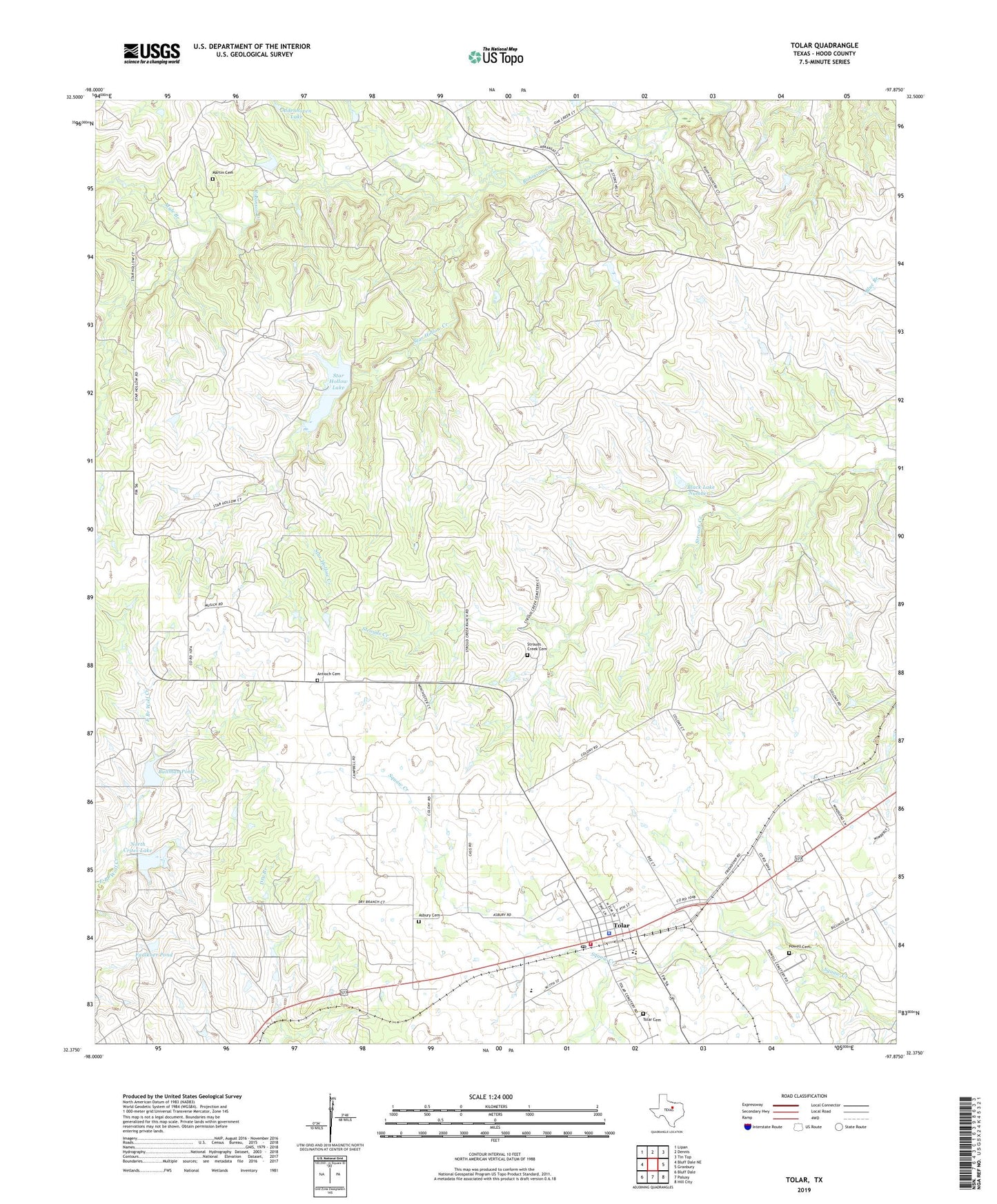
2023 topographic map quadrangle Tolar in the state of Texas. Scale: 1:24000. Based on the newly updated USGS 7.5' US Topo map series, this map is in the following counties: Hood. The map contains contour data, water features, and other items you are used to seeing on USGS maps, but also has updated roads and other features. This is the next generation of topographic maps. Printed on high-quality waterproof paper with UV fade-resistant inks.
Quads adjacent to this one:
West: Bluff Dale NE
Northwest: Lipan
North: Dennis
Northeast: Tin Top
East: Granbury
Southeast: Hill City
South: Paluxy
Southwest: Bluff Dale
This map covers the same area as the classic USGS quad with code o32097d8.
Contains the following named places: Aldenhoven Lake, Antioch Cemetery, Asbury Cemetery, Black Lake Number 7, Black Lake Number 7 Dam, Bullman Pond, Bullman Pond Dam, City of Tolar, Faulkner Dam, Faulkner Pond, First Baptist Church of Thorp Springs, Granbury West Division, Martin Cemetery, Mule Branch, North Crites Dam, North Crites Lake, Powell Cemetery, Rattler Pit Stadium, Star Hollow Creek, Star Hollow Lake, Star Hollow Lake Dam, Strouds Creek Cemetery, Tolar, Tolar Cemetery, Tolar City Hall, Tolar Elementary School, Tolar High School, Tolar Police Department, Tolar Post Office, Tolar Volunteer Fire Department