
MyTopo
Boling Texas US Topo Map
Couldn't load pickup availability
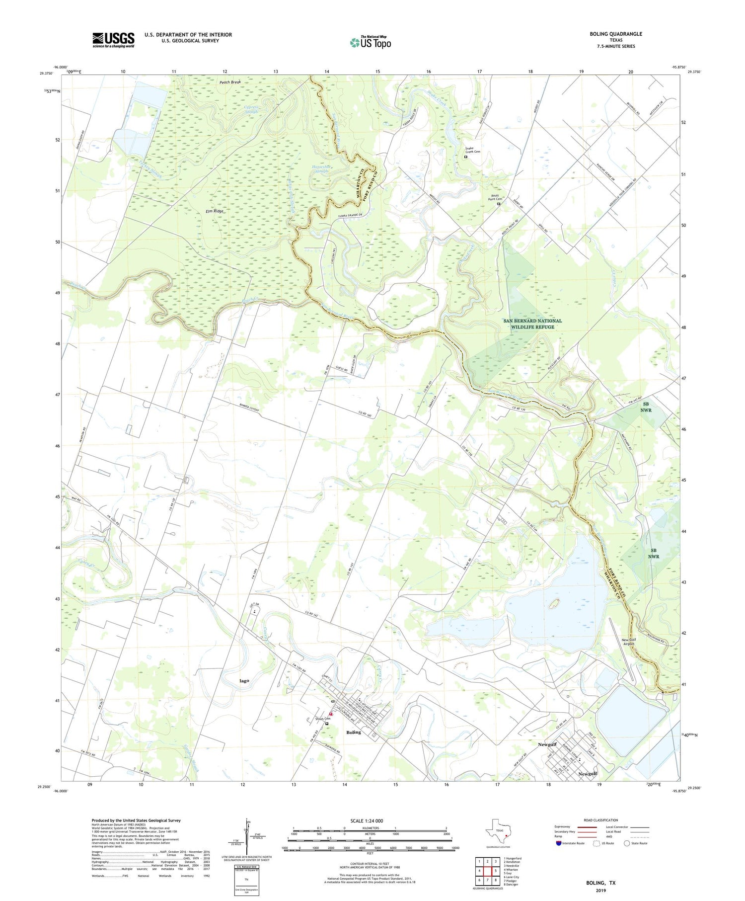
2019 topographic map quadrangle Boling in the state of Texas. Scale: 1:24000. Based on the newly updated USGS 7.5' US Topo map series, this map is in the following counties: Wharton, Fort Bend. The map contains contour data, water features, and other items you are used to seeing on USGS maps, but also has updated roads and other features. This is the next generation of topographic maps. Printed on high-quality waterproof paper with UV fade-resistant inks.
Quads adjacent to this one:
West: Wharton
Northwest: Hungerford
North: Kendleton
Northeast: Needville
East: Guy
Southeast: Danciger
South: Pledger
Southwest: Lane City
Contains the following named places: Boling, Boling Census Designated Place, Boling Fire Department, Boling High School, Boling Oil Field, Boling Post Office, Boling-Iago Census Designated Place, Cypress Slough, Elm Ridge, Four Corners, Horseshoe Lake, Horseshoe Slough, Iago, Iago Census Designated Place, Iago Junior High School, Mount Pen Church, New Gulf Airport, New Gulf Reservoir, Newgulf, Newgulf Elementary School, Peach Break, Peach Creek, Routt Point Cemetery, Routt Point Church, Shiloh Cemetery, Snake Creek, Snake Creek Cemetery, Texas Gulf Incorporated Reservoir Dam, Turkey Slough, Wharton County Sheriff's Office, White Oak Slough, ZIP Code: 77420


