MyTopo
Hungerford Texas US Topo Map
Couldn't load pickup availability
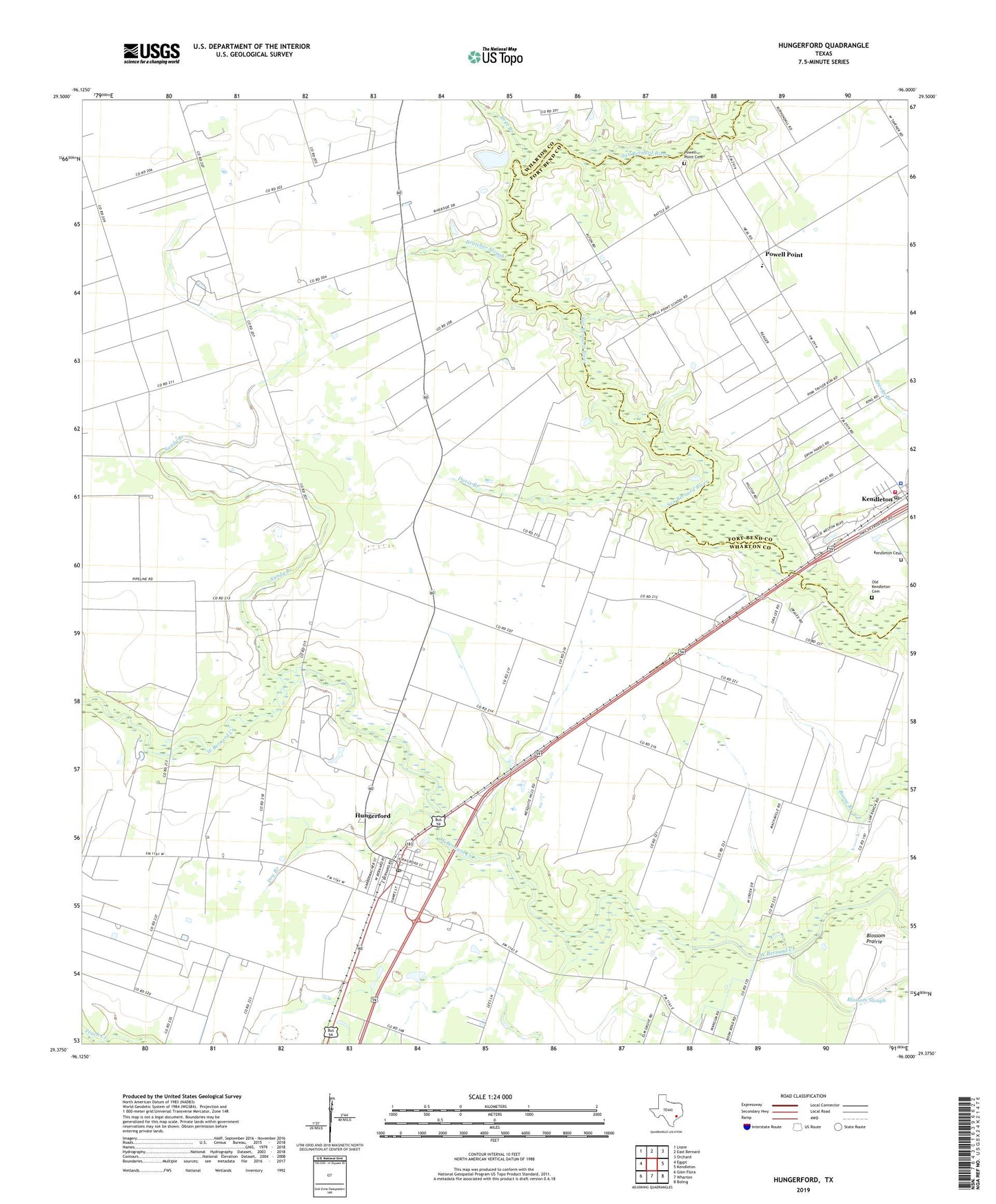
2022 topographic map quadrangle Hungerford in the state of Texas. Scale: 1:24000. Based on the newly updated USGS 7.5' US Topo map series, this map is in the following counties: Wharton, Fort Bend. The map contains contour data, water features, and other items you are used to seeing on USGS maps, but also has updated roads and other features. This is the next generation of topographic maps. Printed on high-quality waterproof paper with UV fade-resistant inks.
Quads adjacent to this one:
West: Egypt
Northwest: Lissie
North: East Bernard
Northeast: Orchard
East: Kendleton
Southeast: Boling
South: Wharton
Southwest: Glen Flora
This map covers the same area as the classic USGS quad with code o29096d1.
Contains the following named places: Blossom Prairie, Blossom Slough, Bratcher Slough, Britt Branch, Center Union Church, City of Kendleton, Davis Branch, Dry Branch, Faith Tabernacle, Hungerford, Hungerford Census Designated Place, Hungerford Consolidated School, Hungerford Oil Field, Hungerford Post Office, Hungerford School, Kendleton Cemetery, Kendleton Police Department, Kendleton Post Office, Kendleton Volunteer Fire Department, Little Zion Church, Old Kendleton Cemetery, Powell Point, Powell Point Cemetery, Powell Point Elementary School, Prairie Grove Church, Sandy Branch, ZIP Codes: 77448, 77451