MyTopo
Needville Texas US Topo Map
Couldn't load pickup availability
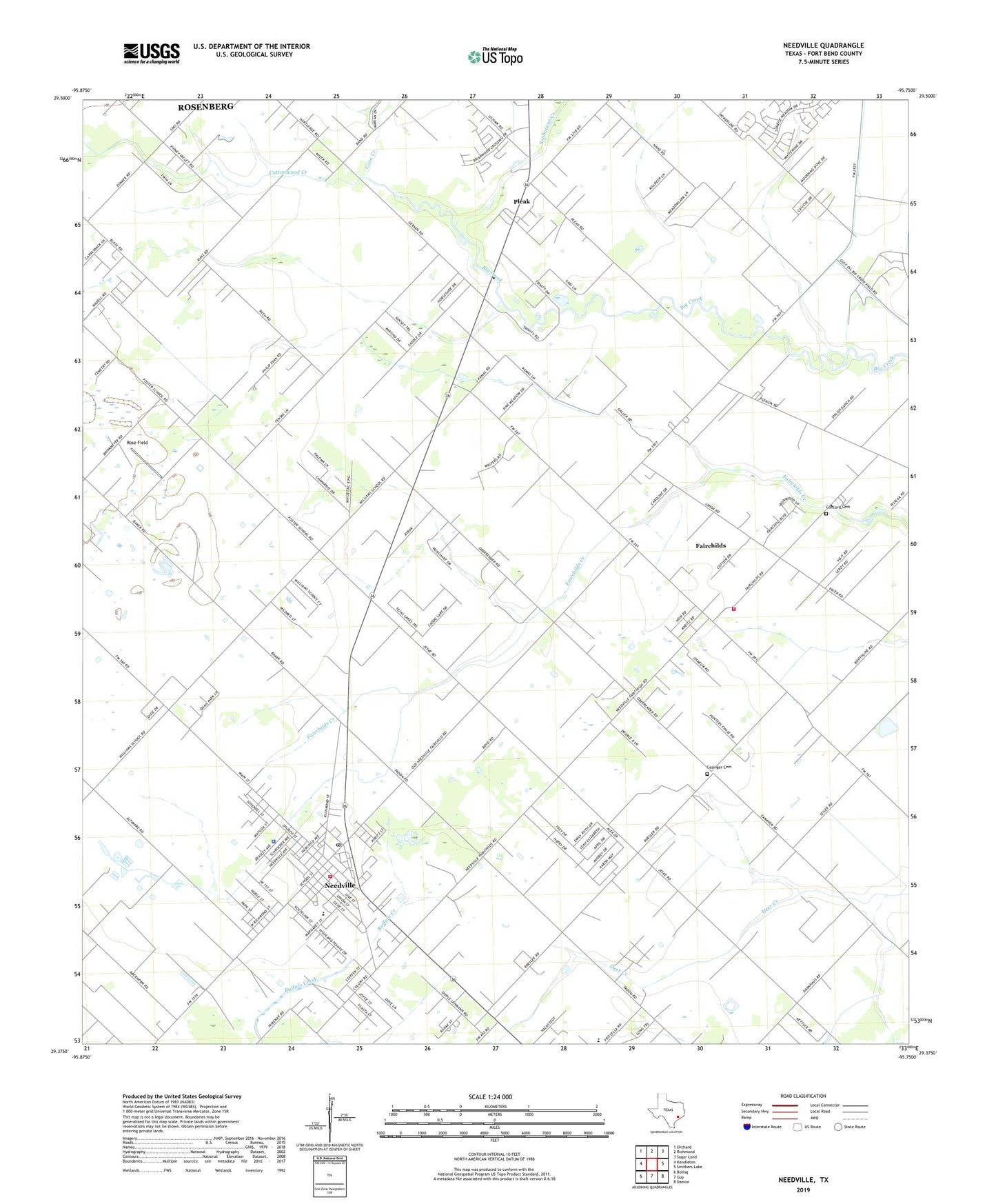
2022 topographic map quadrangle Needville in the state of Texas. Scale: 1:24000. Based on the newly updated USGS 7.5' US Topo map series, this map is in the following counties: Fort Bend. The map contains contour data, water features, and other items you are used to seeing on USGS maps, but also has updated roads and other features. This is the next generation of topographic maps. Printed on high-quality waterproof paper with UV fade-resistant inks.
Quads adjacent to this one:
West: Kendleton
Northwest: Orchard
North: Richmond
Northeast: Sugar Land
East: Smithers Lake
Southeast: Damon
South: Guy
Southwest: Boling
This map covers the same area as the classic USGS quad with code o29095d7.
Contains the following named places: Cesinger Cemetery, City of Needville, Concord Cemetery, Coon Creek, Cottonwood Creek, Fairchild Volunteer Fire Department, Fairchilds, Fort Bend County Constable's Office Precinct 1 Needville Office, Foster School, Needville, Needville City Hall, Needville Community Assembly of God Church, Needville Elementary School, Needville Police Department, Needville Post Office, Needville United Methodist Church, Needville Volunteer Fire Department, Pleak, Rose Field, Saint Michaels Catholic Church, Seabourne Creek, Village of Fairchilds, Village of Pleak, Village of Pleak City Hall, ZIP Code: 77461