MyTopo
Danciger Texas US Topo Map
Couldn't load pickup availability
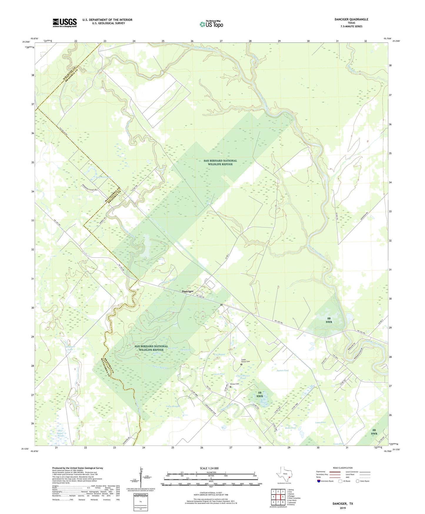
2022 topographic map quadrangle Danciger in the state of Texas. Scale: 1:24000. Based on the newly updated USGS 7.5' US Topo map series, this map is in the following counties: Brazoria, Matagorda, Wharton. The map contains contour data, water features, and other items you are used to seeing on USGS maps, but also has updated roads and other features. This is the next generation of topographic maps. Printed on high-quality waterproof paper with UV fade-resistant inks.
Quads adjacent to this one:
West: Pledger
Northwest: Boling
North: Guy
Northeast: Damon
East: West Columbia
Southeast: Sweeny
South: Ashwood
Southwest: Van Vleck
This map covers the same area as the classic USGS quad with code o29095b7.
Contains the following named places: Alligator Lake, Big Pond, Bird Pond, Black Lake, Blue Pond, Brown Cemetery, Camp Pond, Carson Pond, Cat Bayou, Cedar Creek, Churchhouse Pond, Danciger, Danciger Post Office, Jug Hole, Lones Pond, Pasture Pond, Pledger Gas Field, Rusha Pond, Saint Mary Church, Saint Marys Cemetery, Sawmill Lake, Shoe Sugar Pond, Vinie Slough